Unlocking New Heights: The NiVO VTOL Drone with Technogis GNSS RTK for Precision and Efficiency
In today’s competitive landscape, companies that leverage cutting-edge technology stand out. At Technogis Indonesia, we proudly present the NiVO VTOL drone, seamlessly integrated with our Technogis GNSS RTK system, offering businesses a powerful solution for precision mapping, surveying, and operational efficiency. This innovative integration is designed to meet the demands of industries that require not only advanced technology but also the highest level of accuracy and reliability.
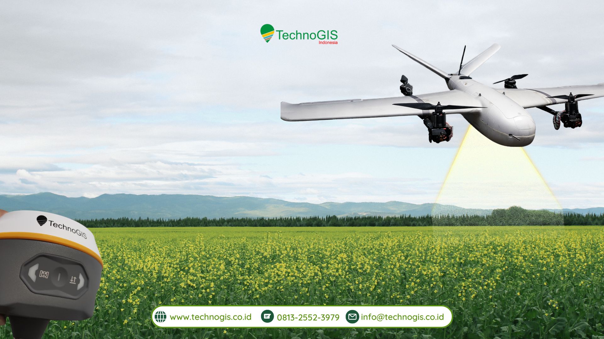
The NiVO VTOL Drone: Versatility in Motion
The NiVO VTOL (Vertical Take-Off and Landing) drone is an industry-leading solution that combines the best features of both multicopter and fixed-wing drones. Its ability to take off and land vertically means it can operate in spaces where other drones might struggle. From urban environments to rugged, confined spaces, the NiVO can fly where traditional aircraft cannot.
Once airborne, it seamlessly transitions into fixed-wing flight, offering extended flight times and increased energy efficiency for covering large areas. This hybrid design makes the NiVO VTOL ideal for a wide range of applications—from agricultural surveys to infrastructure inspections and environmental monitoring.
Technogis GNSS RTK: Elevating Precision to the Next Level
When it comes to aerial data collection, accuracy is paramount. That’s where Technogis GNSS RTK comes in. By enhancing standard GPS technology, RTK provides centimeter-level precision, ensuring that every piece of data captured by the NiVO drone is geo-referenced with unmatched accuracy.
This level of precision is critical in industries such as land surveying, construction, and agriculture, where even the smallest miscalculations can lead to costly errors. With RTK, businesses can eliminate the need for ground control points, speed up workflows, and ensure that the data is both reliable and actionable.
How It Works: A Seamless Integration
The NiVO VTOL drone and the Technogis GNSS RTK system work together in a seamless and efficient manner. Here’s how:
-
Base Station Setup: A GNSS base station is established on the ground at a known point. This station collects satellite signals and calculates correction data.
-
Real-Time Corrections: As the NiVO VTOL drone takes flight, it receives the RTK correction data transmitted from the base station in real time, ensuring highly accurate navigation and data capture throughout the flight.
-
Precision Data Capture: With RTK, every piece of data collected—whether it’s an image, sensor reading, or telemetry—is tagged with highly precise geographic coordinates, ensuring that the data is ready to be used immediately without the need for extensive post-processing.
This real-time, high-accuracy positioning ensures that the data you capture is as reliable as it is efficient, reducing the time and cost typically spent on corrections and reprocessing.
Why Choose NiVO VTOL with Technogis GNSS RTK?
The integration of the NiVO VTOL drone with GNSS RTK offers businesses a unique combination of precision, flexibility, and operational efficiency. Let’s explore the core benefits:
-
Centimeter-Level Accuracy: With RTK, your aerial data is accurate to within centimeters, reducing the need for costly ground control points and eliminating errors in your data.
-
Flexible and Efficient Operations: The NiVO’s VTOL design means it can operate in any environment, from tight urban spaces to rugged terrain. It offers unparalleled versatility compared to traditional fixed-wing drones or multicopters.
-
Cost and Time Savings: The NiVO’s long flight endurance means you can cover more ground in fewer flights, saving time and reducing operational costs. Its ability to fly longer distances and handle larger areas makes it a more cost-efficient option for large-scale projects.
-
Enhanced Productivity: The real-time accuracy of RTK reduces the need for post-flight data corrections, allowing for faster project completion and more confident decision-making.
Transforming Industries with Precision and Efficiency
The integration of the NiVO VTOL drone with Technogis GNSS RTK is revolutionizing industries that rely on high-accuracy data collection and operational efficiency. From land surveying and agriculture to infrastructure monitoring and asset inspections, businesses are benefiting from faster data capture, reduced errors, and more informed decision-making.
By offering a solution that combines cutting-edge flight technology with world-class geospatial accuracy, we’re empowering companies to deliver more value to their clients, optimize their workflows, and ultimately achieve better project outcomes.
A Future-Ready Solution
With the NiVO VTOL drone and Technogis GNSS RTK, your business is ready for the future. Whether you’re looking to scale operations, improve accuracy, or reduce costs, this advanced aerial system provides the tools you need to stay ahead in today’s fast-paced, data-driven world.

Leave a Reply
Want to join the discussion?Feel free to contribute!