Tag Archive for: technogis

TechnoGIS to Showcase Cutting-Edge Hydrographic Solutions at World Water Forum 2024 in Bali

TechnoGIS, a leading provider of innovative geospatial solutions, will be participating in the highly anticipated World Water Forum 2024 in Bali, Indonesia. The forum, taking place from 18 to 24 May 2025, is a global platform for policymakers, scientists, and industry leaders to address the critical challenges facing the world’s water resources. This year’s theme, “WATER FOR SHARED PROSPERITY”, underscores the urgency of finding sustainable solutions to water scarcity, pollution, and climate change impacts. TechnoGIS, dedicated to advancing geospatial technology for a better future, will be showcasing its expertise in hydrographic solutions at the forum.

A Pioneer in Geospatial Technology

TechnoGIS has a strong track record of delivering innovative geospatial solutions across various sectors, including water resources management. The company’s commitment to excellence is reflected in its comprehensive portfolio of products and services, ranging from data acquisition and processing to advanced analysis and visualization.

TechnoGIS at the World Water Forum: Focus on Hydrography

At the World Water Forum 2024, TechnoGIS will be presenting its advanced hydrographic solutions, highlighting the company’s dedication to enhancing our understanding of the world’s oceans and waterways. Mr. Cahyo, TechnoGIS’s Business Development expert in Hydrography, will be leading the company’s participation at the forum. Mr. Cahyo brings extensive experience in the field and will be available to discuss the company’s cutting-edge solutions, including: Blue Marine, a revolutionary software platform for processing satellite imagery for marine applications. Blue Marine empowers users to extract valuable insights from satellite data, enabling accurate mapping of coastal zones, monitoring changes in water quality, and identifying potential threats to marine ecosystems.

Blue Marine Echosounder, a state-of-the-art device for conducting bathymetric surveys. This robust and reliable tool provides high-resolution data on water depth, bottom topography, and underwater features, essential for navigation, dredging operations, and underwater infrastructure development.

TechnoGIS’s Commitment to Sustainable Water Management

TechnoGIS believes that technology plays a crucial role in addressing the global water crisis. The company’s hydrographic solutions provide valuable data and insights that enable informed decision-making in water resource management. By empowering stakeholders with accurate and timely information, TechnoGIS contributes to the development of sustainable water policies and practices.

TechnoGIS join on Indonesia Bussines Matching 2024 “Belanja Produk Dalam Negeri” in Bali and Reach Potential 1.5 Million Rupiah

TechnoGIS, a trailblazing geospatial technology company, is set to make waves at the upcoming Indonesia Business Matching 2024 event themed “Belanja Produk Dalam Negeri” in Bali. The company is geared up to showcase its cutting-edge spatial analysis solutions and introduce the revolutionary TGS low-cost mapping services that promise to revolutionize the industry while providing access to potential customers at an affordable price point of 1.5 million rupiah.

The participation of TechnoGIS at the Indonesia Business Matching 2024 event underscores the company’s commitment to supporting local businesses and driving innovation in the geospatial technology sector. By bringing to the forefront its spatial analysis expertise and the TGS low-cost mapping services, TechnoGIS is poised to offer attendees a glimpse into the future of geospatial solutions.

“We are excited to be a part of Indonesia Business Matching 2024 and to showcase our latest innovations in spatial analysis and mapping services,” said a representative from TechnoGIS. “Our goal is to empower businesses with the tools they need to make informed decisions and unlock new opportunities through geospatial intelligence.”

The TGS low-cost mapping services introduced by TechnoGIS are designed to provide businesses with a cost-effective solution for their mapping needs. By leveraging advanced spatial analysis techniques, the company is able to offer high-quality mapping services at a fraction of the traditional cost, making it accessible to a wider range of businesses and industries.

“At TechnoGIS, we believe in democratizing access to geospatial technology and empowering businesses of all sizes to harness the power of spatial analysis,” added the representative. “Our TGS low-cost mapping services are a testament to our dedication to driving innovation and creating value for our customers.”

Through its participation in the Indonesia Business Matching 2024 event, TechnoGIS aims to connect with local businesses, showcase its capabilities in spatial analysis and mapping, and demonstrate how geospatial technology can drive growth and success in the Indonesian market.

For businesses looking to unlock new opportunities, make informed decisions, and enhance their operations through geospatial intelligence, a visit to the TechnoGIS booth at Indonesia Business Matching 2024 in Bali is a must. Discover the future of geospatial technology and see firsthand how spatial analysis and TGS low-cost mapping services can transform your business.

TechnoGIS CEO, Mr. Sarono, Appointed as Research and Innovation Lead in Starfindo (Asosiasi Startup for Industry Indonesia): Pioneering Start-up for Industry Advancement in Indonesia

Starfindo (Asosiasi Startup for Industry Indonesia), a leading startup dedicated to catalyzing innovation within the Indonesian industrial sector, proudly announces the appointment of Mr. Sarono, CEO of TechnoGIS, as its Research and Innovation Lead. Effective immediately, Mr. Sarono will spearhead strategic initiatives aimed at fostering research collaboration, industry-academic partnerships, and societal impact through innovative programs.

With an illustrious career spanning decades in the technology and innovation landscape, Mr. Sarono brings a wealth of experience and expertise to his new role. As the former CEO of TechnoGIS, a renowned technology solutions provider, he has consistently demonstrated visionary leadership and a commitment to driving impactful change through cutting-edge technologies. In his capacity as the Research and Innovation Lead at Starfindo, Mr. Sarono will focus on pioneering initiatives that bridge the gap between academia, industry, and society. Among the flagship programs under his leadership are:

1. Starfindo Goes to Campus: This groundbreaking initiative aims to connect industry professionals with students and faculty members at leading academic institutions across Indonesia. By organizing workshops, seminars, and collaborative projects, Starfindo seeks to foster a culture of innovation and entrepreneurship among the next generation of talent.

2. Starfindo Research Collaboration: Leveraging the collective expertise of industry leaders, academic researchers, and technology innovators, this program will facilitate interdisciplinary research collaborations. By identifying key challenges facing the industry and harnessing the power of collaboration, Starfindo aims to drive breakthrough innovations that address real-world problems.

3. Starfindo Risearch for Society: Recognizing the importance of technology-driven solutions in addressing societal challenges, this initiative will focus on leveraging research and innovation to create positive social impact. From healthcare and education to environmental sustainability, Starfindo is committed to using its resources to improve the lives of people across Indonesia.

Commenting on his new role, Mr. Sarono expressed his enthusiasm for the opportunity to drive meaningful change within the Indonesian industrial landscape. He stated, “I am honored to join Starfindo as the Research and Innovation Lead and look forward to collaborating with industry stakeholders, academic institutions, and community partners to drive innovation and foster sustainable development. Together, we have the opportunity to unlock new possibilities and create a brighter future for Indonesia.”

Mr. Sarono’s appointment comes at a pivotal moment for Starfindo as the startup continues to expand its presence and influence within the Indonesian innovation ecosystem. With his visionary leadership and track record of success, Mr. Sarono is poised to lead Starfindo to new heights of excellence and impact.

About Starfindo:
Starfindo is a pioneering startup dedicated to driving innovation and advancement within the Indonesian industrial sector. Through strategic partnerships, collaborative research initiatives, and impactful programs, Starfindo aims to catalyze positive change and foster sustainable development in Indonesia.

TechnoGIS Partners with D4 SIG, Sekolah Vokasi UGM to Validate and Develop TGS Low-Cost RTK for Rural Mapping in Indonesia

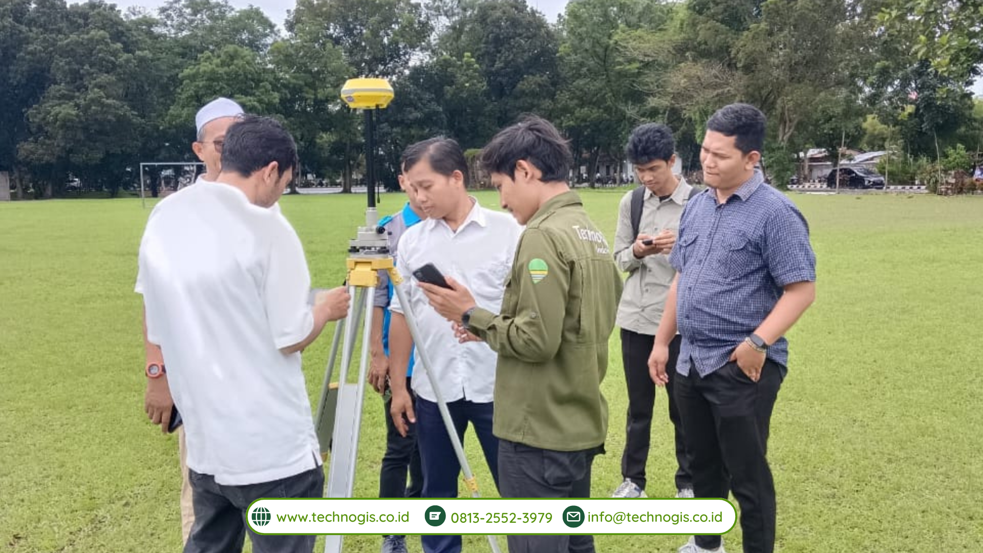
TechnoGIS, a leading provider of geographic information systems (GIS) solutions, has announced a strategic partnership with D4 SIG, Sekolah Vokasi UGM (D4 Spatial Information Engineering, Vocational School, Universitas Gadjah Mada) to validate and develop TGS Low-Cost Real-Time Kinematic (RTK) technology for rural mapping in Indonesia. This collaboration aims to enhance the accessibility and accuracy of mapping solutions, particularly in rural areas, to support sustainable development initiatives across the country.

The partnership between TechnoGIS and D4 SIG, Sekolah Vokasi UGM, marks a significant step forward in leveraging advanced geospatial technologies to address the challenges faced by rural communities in Indonesia. By combining TechnoGIS’s expertise in GIS solutions with D4 SIG’s research capabilities and academic insights, the collaboration seeks to bridge the gap between technological innovation and practical application in rural mapping.

The TGS Low-Cost RTK technology developed by TechnoGIS offers a cost-effective and reliable solution for real-time positioning and mapping, particularly in remote and underserved areas. By utilizing low-cost hardware and open-source software, TGS Low-Cost RTK provides an affordable alternative to traditional RTK systems, making it accessible to a wider range of users, including small-scale farmers, local governments, and community organizations.

As part of the partnership, D4 SIG, Sekolah Vokasi UGM, will play a crucial role in validating and refining the TGS Low-Cost RTK technology through field testing and research activities. Drawing on their expertise in spatial information engineering and geospatial analysis, the academic team will collaborate closely with TechnoGIS to assess the performance, accuracy, and usability of the technology in real-world rural mapping scenarios.

“We are excited to collaborate with D4 SIG, Sekolah Vokasi UGM, to validate and further develop our TGS Low-Cost RTK technology for rural mapping applications in Indonesia,” said Mr. Sarono, CEO of TechnoGIS. “This partnership underscores our commitment to leveraging innovation to address the unique challenges faced by rural communities and contribute to sustainable development efforts across the country.”

Dr. Taufik, Head of D4 SIG, Sekolah Vokasi UGM, expressed her enthusiasm about the collaboration, stating, “As an academic institution dedicated to advancing spatial information engineering, we are thrilled to partner with TechnoGIS to validate and enhance the TGS Low-Cost RTK technology. This collaboration not only provides valuable learning opportunities for our students but also contributes to the advancement of geospatial technologies in Indonesia.”

The validation and development of the TGS Low-Cost RTK technology will involve extensive field testing in collaboration with local communities, government agencies, and non-profit organizations. By gathering feedback and insights from end-users, TechnoGIS and D4 SIG, Sekolah Vokasi UGM, aim to refine the technology to better meet the needs and requirements of rural mapping stakeholders.

The partnership between TechnoGIS and D4 SIG, Sekolah Vokasi UGM, reflects a shared commitment to harnessing the power of geospatial technologies for social impact and sustainable development. By validating and developing the TGS Low-Cost RTK technology for rural mapping in Indonesia, the collaboration aims to empower local communities, improve decision-making processes, and support inclusive development initiatives across the country.

About TechnoGIS:
TechnoGIS is a leading provider of geographic information systems (GIS) solutions, offering a wide range of products and services to clients across various industries. With a focus on innovation, quality, and customer satisfaction, TechnoGIS is committed to delivering cutting-edge solutions that empower organizations to harness the power of spatial data for informed decision-making.

About D4 SIG, Sekolah Vokasi UGM:
D4 SIG, Sekolah Vokasi UGM (D4 Spatial Information Engineering, Vocational School, Universitas Gadjah Mada) is an academic institution dedicated to advancing spatial information engineering through education, research, and community engagement. With a focus on practical applications and interdisciplinary collaboration, D4 SIG prepares students to become skilled professionals in the field of geospatial technologies.

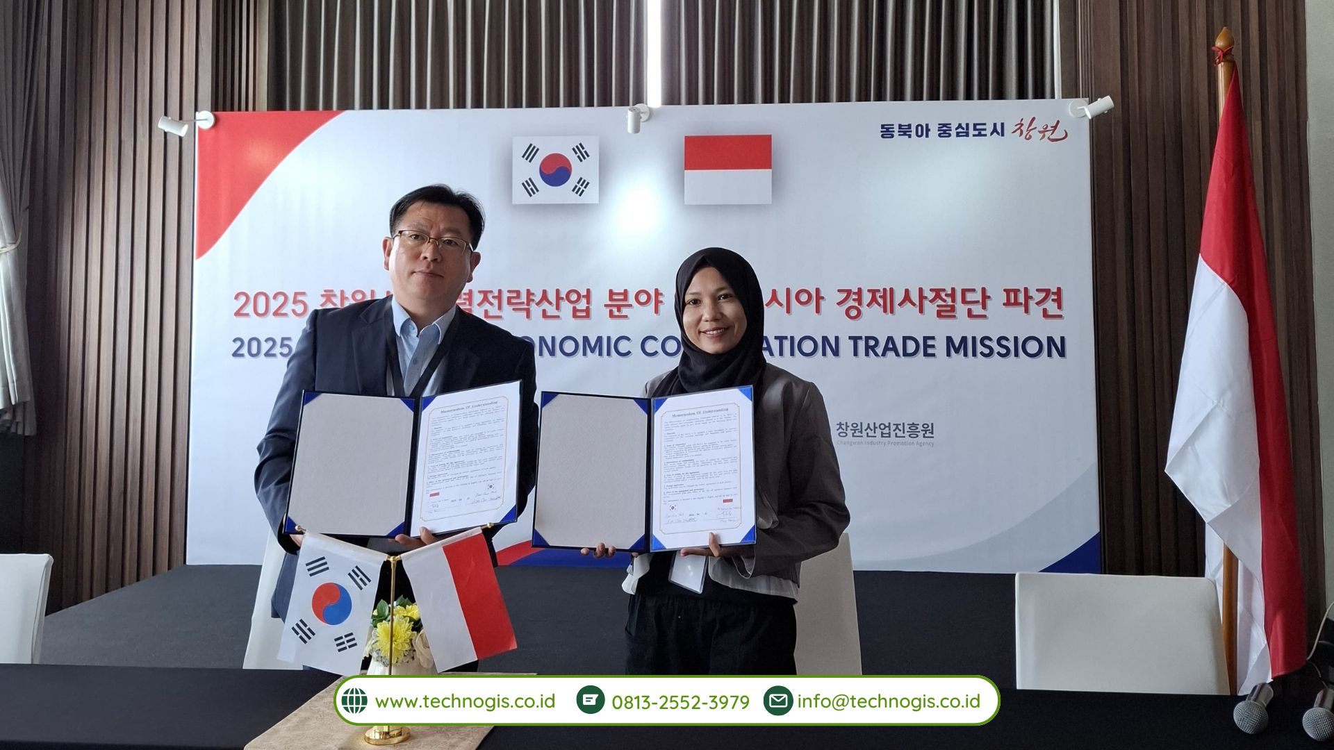
TechnoGIS Signs MoU with Map2u from Malaysia to bring Mapping Solution in Indonesia and Malaysia with IoT Device and Innovation

TechnoGIS, a leading provider of geographic information systems (GIS) solutions, has entered into a Memorandum of Understanding (MoU) with Map2u, a renowned Malaysian mapping technology company, to introduce cutting-edge mapping solutions in Indonesia and Malaysia. This collaboration aims to leverage IoT devices and innovative technologies to revolutionize mapping services in the region.

The MoU signing ceremony took place at TechnoGIS headquarters, attended by key executives and representatives from both companies. This strategic partnership signifies a significant milestone in advancing geospatial technologies and strengthening regional cooperation in the field of mapping and GIS solutions.

Under the terms of the agreement, TechnoGIS and Map2u will collaborate closely to integrate their expertise and resources to develop state-of-the-art mapping solutions tailored to the unique needs of Indonesia and Malaysia. The partnership will focus on leveraging IoT devices and innovative technologies to enhance the accuracy, efficiency, and accessibility of mapping services across various sectors, including urban planning, transportation, agriculture, natural resource management, and disaster response.

Mr. Sarono, CEO of TechnoGIS, expressed his enthusiasm about the partnership, stating, “We are thrilled to collaborate with Map2u to bring advanced mapping solutions to Indonesia and Malaysia. This partnership combines our expertise in GIS with Map2u’s innovative technologies, enabling us to deliver cutting-edge solutions that address the evolving needs of our clients and contribute to the socio-economic development of the region.”

Map2u, known for its expertise in developing innovative mapping technologies, views this collaboration as an opportunity to expand its footprint in Southeast Asia and contribute to the advancement of geospatial capabilities in the region.

One of the key highlights of this collaboration is the integration of IoT devices into mapping solutions, enabling real-time data collection, monitoring, and analysis. By harnessing the power of IoT, TechnoGIS and Map2u seek to provide decision-makers with actionable insights and enable proactive decision-making across various sectors. Furthermore, the partnership will focus on fostering innovation in mapping technologies, including the development of advanced algorithms, machine learning models, and data visualization techniques. By staying at the forefront of technological advancements, TechnoGIS and Map2u aim to continuously enhance the capabilities of their mapping solutions and stay ahead of evolving customer needs and market trends.

The collaboration between TechnoGIS and Map2u is poised to redefine the landscape of mapping services in Indonesia and Malaysia, offering scalable, customizable, and cost-effective solutions that cater to the diverse needs of businesses, government agencies, and non-profit organizations.

About TechnoGIS:
TechnoGIS is a leading provider of geographic information systems (GIS) solutions, offering a wide range of products and services to clients across various industries. With a focus on innovation, quality, and customer satisfaction, TechnoGIS is committed to delivering cutting-edge solutions that empower organizations to harness the power of spatial data for informed decision-making.

About Map2u:
Map2u is a Malaysian-based mapping technology company specializing in the development of innovative mapping solutions for businesses and governments. With a strong focus on research and development, Map2u is dedicated to pushing the boundaries of geospatial technologies to deliver impactful solutions that address the complex challenges of the modern world.

TechnoGIS Partnership With Universitas Muhammadiyah Surakarta on Kampus Merdeka Program’s

TechnoGIS is thrilled to announce its groundbreaking partnership with Universitas Muhammadiyah Surakarta on the Kampus Merdeka Program. This collaboration marks a significant milestone in the journey towards fostering technological innovation and academic excellence in Indonesia.

The Kampus Merdeka Program, initiated by the Indonesian Ministry of Education and Culture, aims to transform higher education institutions into hubs of innovation and creativity. Universitas Muhammadiyah Surakarta has been at the forefront of this initiative, embracing the spirit of Kampus Merdeka to drive positive change in the education sector. As a leading technology company committed to driving digital transformation, TechnoGIS recognizes the importance of collaboration between academia and industry. By partnering with Universitas Muhammadiyah Surakarta, we aim to bridge the gap between theory and practice, providing students with real-world experience and industry insights that will prepare them for future careers in the tech sector.

Through this partnership, TechnoGIS will work closely with the faculty and students of Universitas Muhammadiyah Surakarta to co-create innovative solutions and projects. By leveraging our expertise in geospatial technology and data analytics, we will support research initiatives, practical training programs, and industry projects that align with the goals of the Kampus Merdeka Program. One of the key focus areas of our collaboration will be to explore the applications of geospatial technology in solving real-world challenges. From urban planning and environmental management to disaster response and precision agriculture, there is immense potential for geospatial solutions to make a positive impact on society.

Furthermore, TechnoGIS is committed to fostering a culture of innovation and entrepreneurship among students at Universitas Muhammadiyah Surakarta. Through mentorship programs, hackathons, and industry partnerships, we will provide students with the resources and support they need to turn their ideas into reality and launch successful tech startups. By bridging the gap between academia and industry, TechnoGIS and Universitas Muhammadiyah Surakarta are positioning themselves at the forefront of the digital revolution in Indonesia. Together, we will nurture the next generation of tech leaders and innovators, driving economic growth and societal progress through the power of technology.

TechnoGIS Doing Collaboration with Tech Startup and Robotic Assosiation in Roboworld Korea 2023

TechnoGIS Doing Collaboration with Tech Startup and Robotic Assosiation in Roboworld Korea 2023 -TechnoGIS is embarking on an exciting collaboration with Tech Startup and Robotic Association in Roboworld Korea 2023. This innovative partnership aims to revolutionize the way we perceive technology and its impact on our world. By joining forces with cutting-edge startups and experts in the field of robotics, TechnoGIS is paving the way for groundbreaking advancements in the industry.

Through this collaboration, TechnoGIS will have access to the latest technological developments and expertise, allowing us to stay at the forefront of innovation. The synergy between our team and the Tech Startup and Robotic Association will enable us to create state-of-the-art solutions that will shape the future of technology.

With a shared vision of pushing boundaries and exploring new possibilities, TechnoGIS, Tech Startup, and the Robotic Association are set to make waves in Roboworld Korea 2023. Together, we will redefine the standards of technological excellence and set new benchmarks for innovation in the global market.

Lebih Dekat Dengan WebGIS

Lebih Dekat Dengan WebGISKetika kita masuk ke dalam bidang geospasial, salah satu perkembangan menarik dari bidang ini dengan teknologi adalah penggunaan WebGIS. Dimana dengan adanya WebGIS ini pemetaan bisa di convert dalam mode digital dan memungkinkan diakses siapa saja dan dimana saja.

WebGIS ini digunakan untuk menyimpan, menganalisis, menampilkan dan melaporkan data keruangan yang sudah dibuat. Dengan penggunaan WebGIS menyebaran informasi tentang data keruangan ini menjadi lebih mudah dan efisien.

Mari kita bahas informasi mengenai WebGIS dalam ulasan berikut :

WebGIS

WebGIS adalah sistem informasi geografis pengembangan dari aplikasi GIS yang merupakan sistem pemetaan digital yang memanfaatkan internet untuk menyimpan, mempublikasi, mengintegrasikan data spasial dalam bentuk teks, peta digital juga menjalankan fungsi analisis.

Bentuk paling sederhana dari WebGIS ini setidaknya terdiri dari dua komponen yaitu server dan client. Dimana server digunakan untuk penyimpanan isi website sedangkan klien adalah web browser. Untuk kemudian pengguna dapat mengakses WebGIS dalam alamat tertentu menggunakan browser.

WebGIS disini cukup berperan dalam memberikan kemudahan penyebaran informasi geospasial, menggantikan cara konvensional. Dari website semua orang bisa mengakses informasi geospasial dengan mudah.

Baca : Apa Itu Drone, UAV dan Puna?

Bagaimana WebGIS Bekerja?

Sesuai dengan penggunaan website lainya, WebGIS pun berjalan dengan menampilkan data dari server sesuai dengan permintaan pengguna.

WebGIS

Bagaimana WebGIS Bekerja

Jadi ketika klien masuk dalam WebGIS, ada permintaan dari client ke server. Selanjutnya server memberi tanggapan permintaan dengan mengirimkan data yang diinginkan. Selanjutnya browser akan menampilkan data tersebut.

Perbedaaan Penggunaan Konvensional GIS dan WebGIS

Selanjutnya penggunaan WebGIS juga lebih memberikan kemudahan untuk pengguna daripada cara konvensional, diantaranya karena webgis bisa lebih mudah diakses.

 Gis KonvensionalWeb Gis
EkonomisXYes
Bisa diakses banyak orangXYes
Bisa diakses dari jarak jauhXYes
Memungkinkan diakses untuk globalXYes
Tidak memerlukan seseorang yang ahli di GISXYes

Perbedaan GIS konvensional dengan WebGIS

1.  WebGIS Hemat untuk Pengguna

Untuk mendapatkan informasi mengenai GIS seseorang tidak perlu merogoh uang yang dalam sebab webGIS sangat memungkinkan untuk diakses dengan bebas dan gratis yang diakses menggunakan website. Hal ini tentunya menjadi kelebihan dari webgis.

2. Bisa Diakses Siapa Saja

Cara yang paling mudah untuk membantu banyak orang mendapatkan informasi GIS adalah dengan menggunakan WebGIS. Dimana Anda tidak perlu menampilkan data secara konvensional namun semua orang bisa serentak mengakses website untuk mendapatkan informasi GIS dengan mudah.

Penggunaan WebGIS tidak terbatas pada satu pengguna, namun bisa diakses banyak orang secara sekaligus.

Selain itu jika WebGIS juga sangat memungkinkan untuk diakses darimana saja dan kapan saja, termasuk dari luar negeri atau lingkup global.

3. Webgis Dirancang Untuk Memberikan Kemudahan

Seperti penggunaan teknologi lainya, WebGIS dirancang untuk memberikan kemudahan untuk pengguna. Dengan begitu seseorang yang ingin memahami informasi GIS bisa dengan mudah mengaksesnya melalui website.

Selain itu hal yang membuat WebGIS menjadi lebih menarik adalah pengguna tidak perlu melakukan instalasi aplikasi atau download terlebih dahulu karena hanya tinggal akses dari website saja.

Apa yang Ditampilkan dalam WebGIS?

Ada beberapa informasi yang ditampilkan dalam WebGIS, diantaranya adalah Peta, Tabel, laporan dan grafik. Hasil ini ditampilan dalam webgis tentunya dengan bahan yang sudah dimiliki misalnya data raw, citra satelit dan foto udara sampai dengan data server dari google maps dan lain sebagainya.


Baca Artikel Tentang : Lidar

Kesimpulan

Nah itulah penjelasan hari ini tentang WebGIS mulai dari pengetian, penggunaan sampai dengan mekanisme WebGISnya. Untuk Anda yang banyak bekerja dengan client di berbagai proyek tentu saja membuat WebGIS menjadi pilihan tersendiri karena kemudahan dan harganya yang cukup ekonomis.

Jika Anda ingin membuat WebGIS bisa banget menggunakan jasa webgis dari Techno GIS Indonesia.

Atau jika Anda ingin langsung terjun dalam pembuatan WebGIS bisa mengikuti pelatihan gis (WebGIS dasar dan lanjut) dari Techno GIS. Dengan langsung menghubungi kontak gis di whatsapp.


Jadwal Pelatihan UAV, REMOTE SENSING, WEBGIS Tahun 2022

Jadwal Pelatihan UAV, REMOTE SENSING, WEBGIS Tahun 2022

JanuariTgl 04 – 06
Tgl 11 – 13
Tgl 18 – 20
Tgl 25 – 27
FebuariTgl 01 – 03
Tgl 08 – 10
Tgl 15 – 17
Tgl 22 – 24
MaretTgl 01 – 03
Tgl 08 – 10
Tgl 15 – 17
Tgl 22 – 24
Tgl 29 – 31
AprilTgl 05 – 07
Tgl 12 – 14
Tgl 19 – 21
Tgl 26 – 28
MeiTgl 03 – 05
JuniTgl 31 Mei – 02 Juni
Tgl 07 – 09
Tgl 14 – 16
Tgl 21 – 23
Tgl 28 – 30
JuliTgl 05 – 07
Tgl 12 – 14
Tgl 21– 23
Tgl 26 – 28
AgustusTgl 02 – 04
Tgl 11 – 13
Tgl 18 – 20
Tgl 23 – 25
Tgl 30 Agustus – 1 September
SeptemberTgl 06 – 08
Tgl 13 – 15
Tgl 20 – 22
Tgl 27 – 29
OktoberTgl 04 – 06
Tgl 11 – 13
Tgl 20 – 22
Tgl 25 – 27
NovemberTgl 01 – 03
Tgl 08 – 10
Tgl 15 – 17
Tgl 22 – 24
Tgl 29 November – 01 Desember
DesemberTgl 06 – 08
Tgl 13 – 15
Tgl 20 – 22

Bagi anda yang ingin mengikuti pelatihan pemetaan menggunakan drone / uav di jogjakarta. Silahkan mendaftar program pelatihan pemetaan drone / uav melalui marketing TechnoGIS Indonesia. Atau hubungi:

Jln Pamularsih No 152B, Klaseman, Sinduharjo, Ngaglik, Sleman, Yogyakarta 55283.

[email protected] / [email protected]

Telp : 0274 – 885879 / Hp : 0813-2552-3979 / Wa : 0813-2552-3979

Informasi Paket Pelatihan Pemetaan UAV/Drone : Pelatihan Drone Pemetaan

Tag Archive for: technogis

Contact

Welcome

Portofolio

About

TechnoGIS Indonesia merupakan perusahaan jasa konsultasi yang bergerak dibidang teknologi informasi yang memiliki banyak cabang konsenterasi. Pada tahun 2012 perusahaan ini dibentuk dilingkungan prodi Kartografi Penginderaan Jauh, Fakultas Geografi, Universitas Gadjah Mada dan diresmikan secara hukum pada Januari 2015.
TechnoGIS Indonesia merupakan brand yang berfokus pada informasi dan teknologi spasial, seperti survei, pemetaan, analisis spasial, pemrosesan citra digital, pembuatan WebGIS, maupun kegiatan lainnya yang berkaitan dengan teknologi dan analisis keruangan.
TechnoGIS Indonesia memiliki komitmen yang tinggi terhadap kualitas layanan dan telah berkembang. Layanan konsultan yang telah kami kembangkan antara lain :
1. Konsultasi Teknologi Informasi
2. Survei dan Pemetaan
3. Pengolahan Citra Satelit
4. Pembuatan WebGIS
5. Penyewaan Server WebGIS
6. Penjualan Citra Satelit dan Jasa Pemrosesan Citra
7. Penjualan Software Pemetaan
8. Pelatihan Teknologi Informasi
9. Pelatihan Pembuatan Website
10. Pelatihan SIG Dasar, SIG Lanjut, Pengolahan Citra Digital (Dasar atau Tematik), dan
Pelatihan WebGIS , Pelatihan Drone
11. Distributor Alat Survei dan Pemetaan
12. Jasa Percetakan dan Penerbitan Buku

VISI
“Menjadikan Perusahaan berbasis pemikiran keruangan (spasial) yang bersemangat melakukan perubahan dan dapat berguna bagi masyarakat.“

MISI
1. Meningkatkan Kualitas dan kesejahteraan SDM.
2. Berpikir inovatif dan kreatif dalam menciptakan sebuah karya.
3. Mengamalkan ilmu yang bermanfaat di dalam masyarakat.
4. Berinovasi untuk kemajuan, khususnya di bidang teknologi spasial di masyarakat.