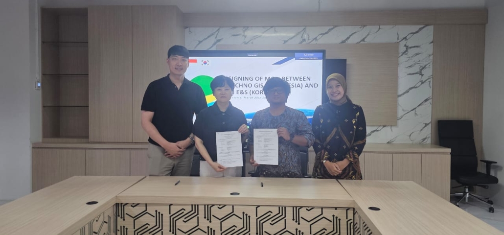
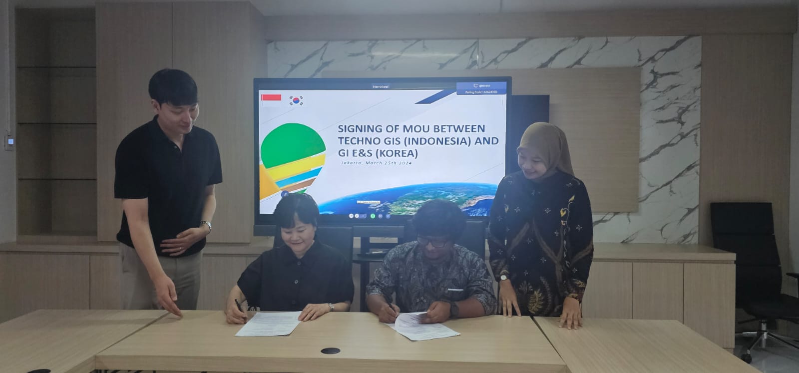
Partnership with GI E&S from Korea, TechnoGIS Indonesia Want to Bring the Geospatial Technology in Atmosphere and Climate Sectors
TechnoGIS, a leading geospatial technology company based in Indonesia, has announced an exciting new partnership with GI E&S, a prominent firm from Korea known for their expertise in Earth and Space data solutions. This collaboration aims to deliver innovative geospatial solutions that utilize satellite imagery to address critical issues related to geomaritime and geoclimate in Indonesia.
The partnership between TechnoGIS and GI E&S represents a significant step forward in harnessing the power of geospatial data to make informed decisions and drive positive change. By combining their respective strengths, the two companies are poised to revolutionize the way geospatial information is used to tackle challenges in the maritime and climate sectors.
One of the key focus areas of this partnership is geomaritime solutions. With Indonesia being an archipelagic nation comprising thousands of islands, the need for accurate geospatial data to support maritime activities is crucial. TechnoGIS and GI E&S will work together to develop advanced technologies that provide real-time insights into maritime navigation, resource management, and environmental monitoring.
In addition to geomaritime solutions, the collaboration will also address geoclimate challenges in Indonesia. With the increasing impact of climate change on the region, there is a growing demand for innovative approaches to monitor and mitigate environmental risks. By leveraging satellite imagery and geospatial analytics, TechnoGIS and GI E&S aim to provide decision-makers with the tools they need to better understand and respond to changing climate patterns.
“We are thrilled to partner with GI E&S to bring cutting-edge geospatial solutions to Indonesia,” said Mr Sarono, CEO of TechnoGIS. “By combining our expertise in geospatial technology with GI E&S’s domain knowledge in Earth and Space data, we are confident that we can make a positive impact on critical issues such as geomaritime and geoclimate in our country.”
The partnership between TechnoGIS and GI E&S underscores the importance of collaboration in driving innovation and creating sustainable solutions for pressing global challenges. By working together, the two companies aim to unlock the full potential of geospatial technology to build a more resilient and sustainable future for Indonesia and beyond.
For more information about the TechnoGIS and GI E&S partnership and their work on geospatial solutions for geomaritime and geoclimate in Indonesia, please visit their respective websites or contact their representatives directly.


Leave a Reply
Want to join the discussion?Feel free to contribute!