NiVO V2: The Ultimate Drone for Professional Aerial Surveying
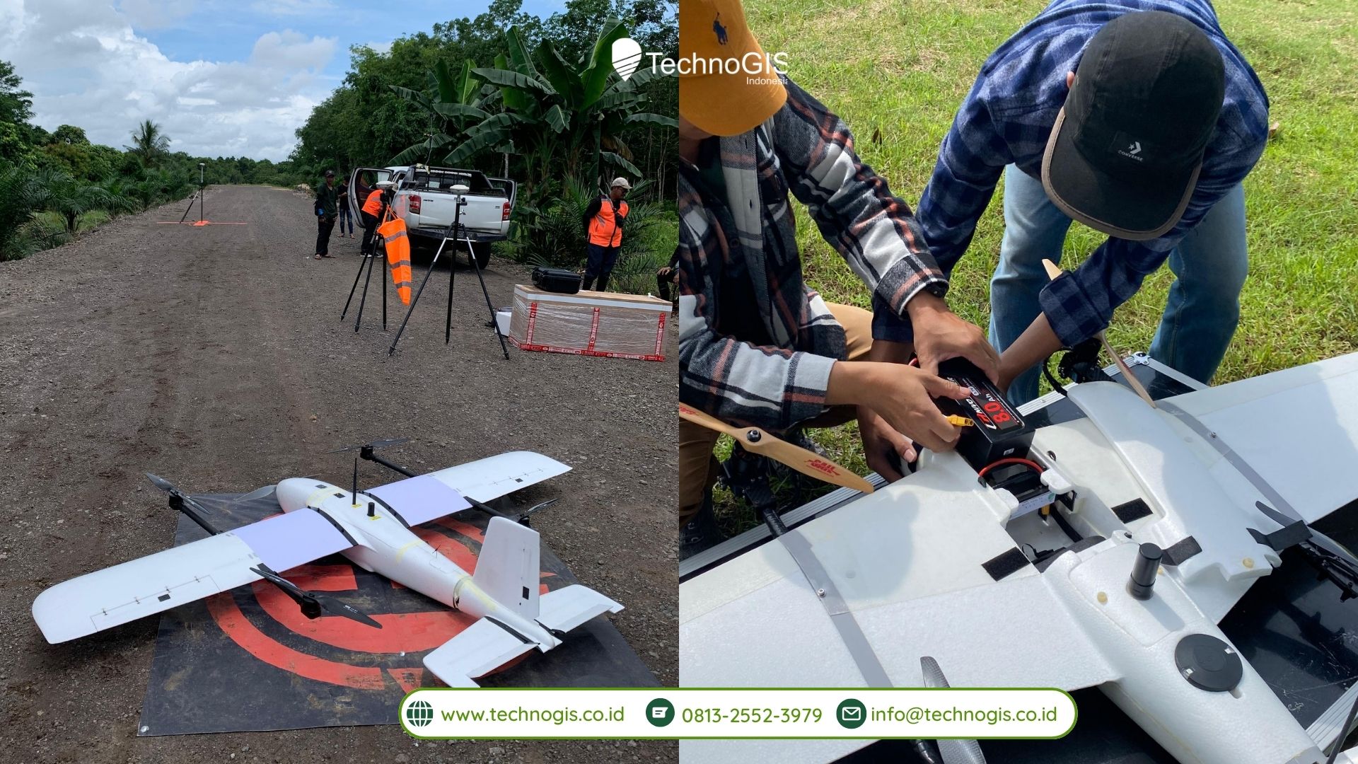
The NiVO V2 VTOL (Vertical Takeoff and Landing) drone is a state-of-the-art solution designed for high-precision aerial surveying and mapping. Engineered for professionals such as surveyors, engineers, and geospatial experts, this drone combines advanced technology with an efficient flight system, making it the ideal tool for a variety of industries, including land surveying, agriculture, and infrastructure monitoring.
One of the standout features of the NiVO V2 is its ability to capture exceptionally accurate data. Equipped with high-resolution cameras, including a 24.3 MP RGB camera, the drone delivers detailed aerial images suitable for topographic mapping and environmental analysis. Additionally, it supports specialized sensors such as Landcam Multispectral and GeoLiDAR ALS, allowing for comprehensive data collection with a ground sampling accuracy of up to 2 cm per pixel. These capabilities make it the perfect choice for precise and reliable survey work across diverse fields.
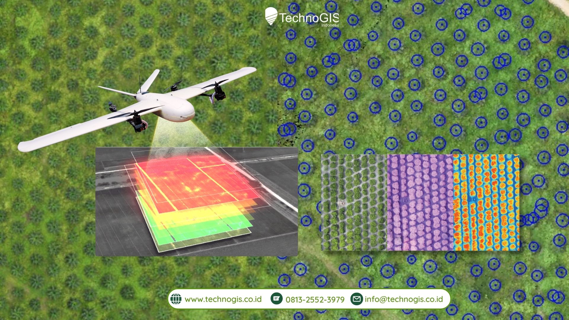
With an optimized flight system, the NiVO V2 offers impressive endurance, allowing it to fly for up to 60 minutes per mission. This extended flight time enables the drone to cover a wide area, making it efficient for large-scale projects such as agricultural surveys or urban development monitoring. The drone can cover areas ranging from 200 to 500 hectares in a single flight, reducing the need for multiple recharges and increasing operational efficiency.
The NiVO V2 also boasts autonomous flight modes, allowing users to pre-program flight paths and conduct surveys with minimal manual intervention. This feature significantly enhances operational efficiency, especially when performing complex or repetitive tasks. The drone’s automatic navigation capabilities ensure that the mission is carried out accurately, with the system handling the flight without the need for continuous input from the operator.
Despite its advanced technology, the NiVO V2 is designed for ease of use. It features a simple control system that can be operated via a mobile app, making it accessible to both seasoned professionals and newcomers to drone technology. This user-friendly interface ensures that even those with minimal experience can operate the drone effectively, reducing the learning curve and allowing for quick deployment.
Built with high-quality materials like Epo Fiber, the NiVO V2 strikes the perfect balance between lightweight design and durability. It’s capable of withstanding various weather conditions without compromising performance, ensuring reliable operation in challenging environments. Its lightweight yet robust construction ensures the drone remains stable, even in harsh conditions, while its ability to carry payloads of up to 1,200 grams offers versatility in terms of sensor and equipment compatibility.
In summary, the NiVO V2 is a powerful, efficient, and user-friendly drone designed to meet the demanding needs of professionals across various industries. With its high-precision data capture, long flight endurance, autonomous capabilities, and durable construction, the NiVO V2 is the ultimate tool for aerial surveying, mapping, and monitoring, providing exceptional value and performance for any project.

Leave a Reply
Want to join the discussion?Feel free to contribute!