TechnoGIS Showcases Geospatial Innovation at Indonesia Drone Expo 2026, Advancing the Future of Precision Mapping and Drone-Based Surveying in Indonesia

Jakarta, Indonesia — Agustus 2026

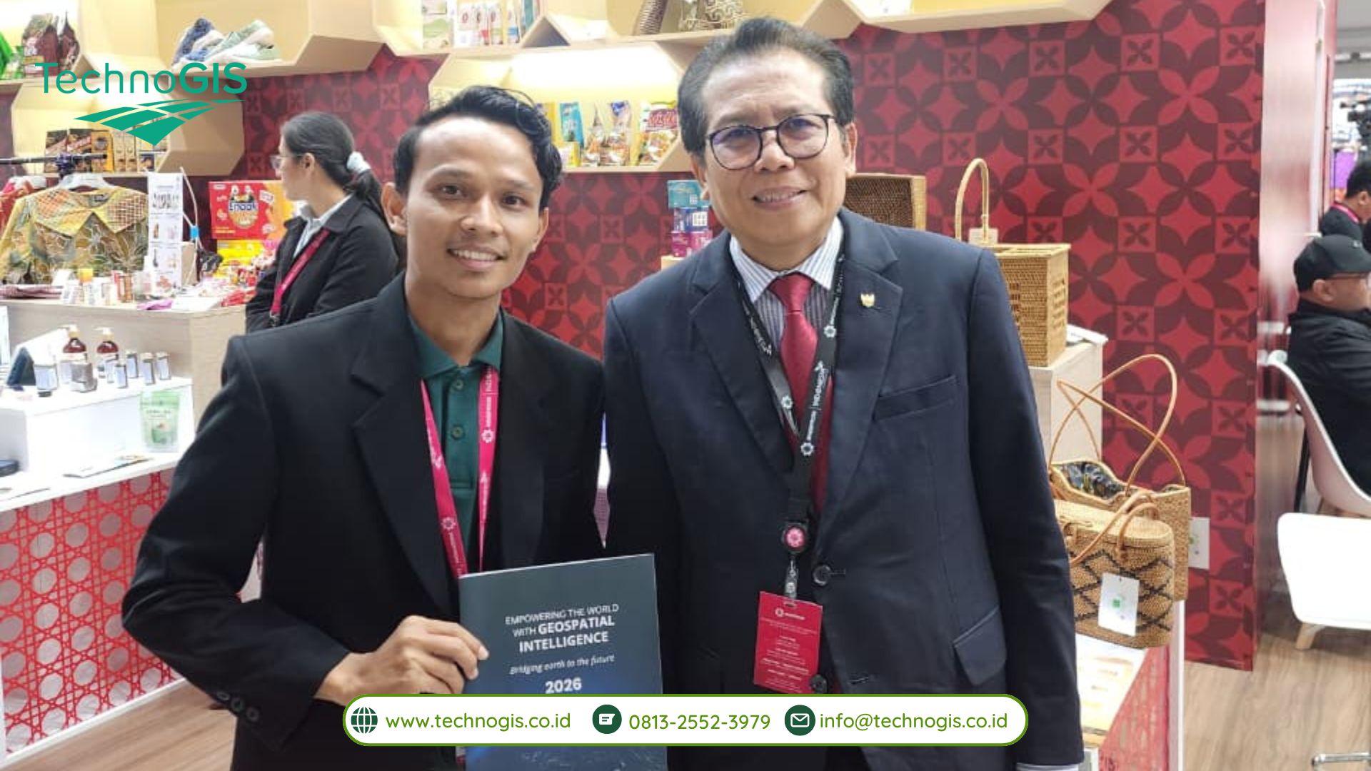
PT Techno GIS Indonesia dengan bangga berpartisipasi dalam Indonesia Drone Expo (IDE) 2026 yang diselenggarakan pada 11–13 Agustus 2026 di JIEXPO Kemayoran, Jakarta. Keikutsertaan ini menjadi momentum bagi TechnoGIS untuk memperkenalkan berbagai inovasi teknologi geospasial sekaligus menunjukkan bagaimana teknologi drone dapat dimanfaatkan untuk mendukung kegiatan pemetaan, survei, dan pengumpulan data spasial yang lebih presisi, efisien, dan terintegrasi.

Indonesia Drone Expo 2026 menjadi salah satu ajang yang mempertemukan berbagai pelaku industri, perusahaan teknologi, profesional, peneliti, serta pemangku kepentingan untuk mengeksplorasi perkembangan terbaru dalam teknologi drone, unmanned aerial systems, pemetaan, survei, remote sensing, dan berbagai aplikasi geospasial.

Melalui keikutsertaan dalam ajang tersebut, TechnoGIS kembali menegaskan komitmennya untuk berkontribusi dalam perkembangan ekosistem teknologi geospasial di Indonesia melalui solusi yang inovatif dan terintegrasi.
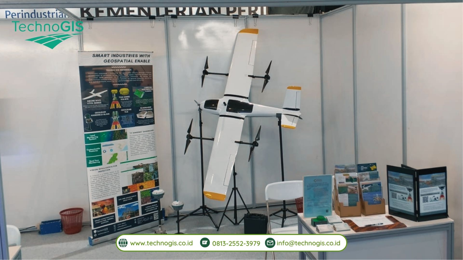
Menampilkan Teknologi Drone dan Solusi Geospasial Terdepan

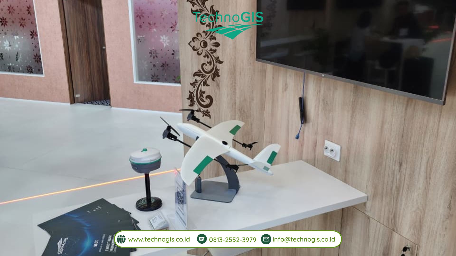
Sebagai perusahaan yang bergerak di bidang teknologi geospasial, peralatan survei, dan solusi pemetaan, TechnoGIS menghadirkan berbagai teknologi yang dirancang untuk mendukung kebutuhan survei dan pemetaan modern.  Dalam booth TechnoGIS, para pengunjung berkesempatan untuk mengenal lebih dekat berbagai solusi, mulai dari NiVO VTOL Mapping System, teknologi UAV LiDAR, GNSS RTK, hingga berbagai perangkat dan solusi survei geospasial lainnya. Integrasi antara UAV, LiDAR, GNSS, RTK/PPK, dan teknologi pengolahan data geospasial memungkinkan proses pengumpulan data dilakukan secara lebih efektif, khususnya untuk wilayah yang luas maupun medan yang memiliki tantangan tersendir. Teknologi tersebut dapat dimanfaatkan dalam berbagai kebutuhan, seperti pemetaan topografi, survei lahan, pemetaan infrastruktur, monitoring wilayah, hingga kebutuhan pengumpulan data spasial untuk mendukung proses pengambilan keputusan

Menghubungkan Inovasi Teknologi dengan Kebutuhan Industri

Tidak hanya menjadi ajang untuk memamerkan produk dan teknologi, Indonesia Drone Expo 2026 juga menjadi kesempatan bagi TechnoGIS untuk membangun koneksi dan berdiskusi secara langsung dengan berbagai profesional serta pelaku industri. Selama kegiatan berlangsung, TechnoGIS berinteraksi dengan pengunjung dan berbagai perwakilan dari sektor industri untuk membahas pemanfaatan teknologi drone dan geospasial dalam berbagai kebutuhan, termasuk pemetaan topografi, survei lahan, pembangunan infrastruktur, pertambangan, perkebunan, kehutanan, monitoring lingkungan, serta berbagai aktivitas berbasis data spasial.

Berbagai diskusi dan pertemuan yang berlangsung selama expo memberikan wawasan mengenai kebutuhan teknologi yang terus berkembang di industri. Interaksi tersebut juga membuka peluang untuk membangun kolaborasi baru serta menghadirkan solusi geospasial yang lebih relevan dengan kebutuhan pengguna di lapangan.
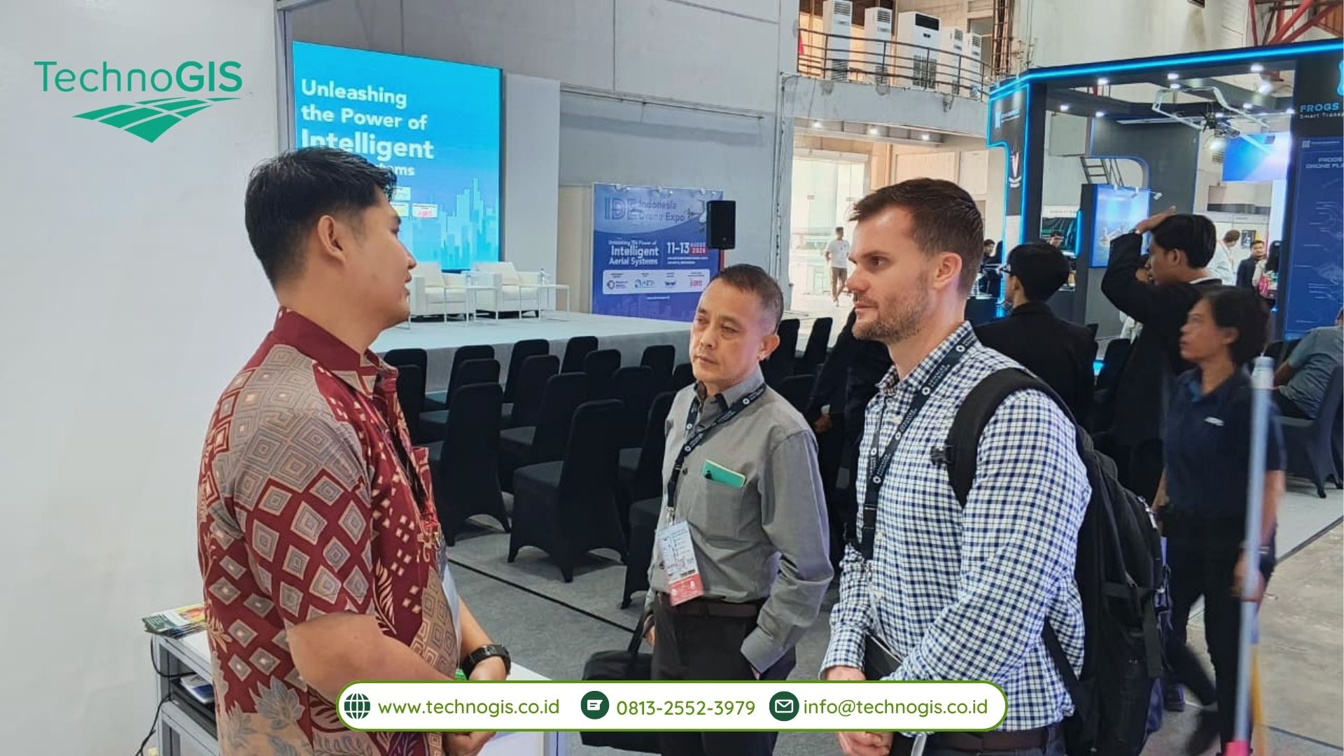
Mendorong Masa Depan Pemetaan yang Lebih Presisi

Perkembangan teknologi drone telah membawa perubahan besar dalam proses pengumpulan data spasial. Ketika dikombinasikan dengan teknologi seperti RTK, PPK, LiDAR, dan remote sensing, drone dapat menjadi salah satu perangkat yang powerful untuk menghasilkan data geospasial yang lebih detail dan komprehensif. TechnoGIS terus berupaya menghadirkan solusi yang mampu menjembatani perkembangan teknologi dengan kebutuhan nyata di berbagai sektor industri. Dengan mengedepankan presisi, efisiensi, inovasi, dan integrasi teknologi, TechnoGIS berkomitmen untuk mendukung semakin luasnya pemanfaatan teknologi geospasial di Indonesia.

Keikutsertaan TechnoGIS dalam Indonesia Drone Expo 2026 menjadi salah satu langkah untuk memperkuat posisi dan kontribusi perusahaan dalam perkembangan ekosistem teknologi drone dan geospasial, baik di tingkat nasional maupun menuju pasar global. Melalui inovasi yang terus dikembangkan, TechnoGIS percaya bahwa masa depan pemetaan bukan hanya tentang bagaimana data dikumpulkan, tetapi juga bagaimana data tersebut dapat diolah menjadi informasi yang bernilai untuk mendukung keputusan yang lebih tepat.
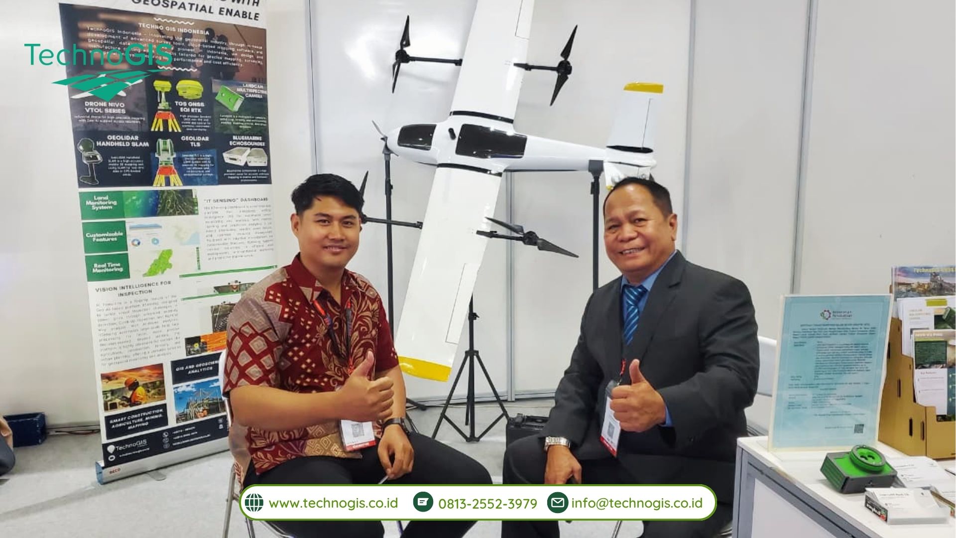
From Drone to Data, TechnoGIS continues to empower smarter mapping through innovative geospatial solutions.
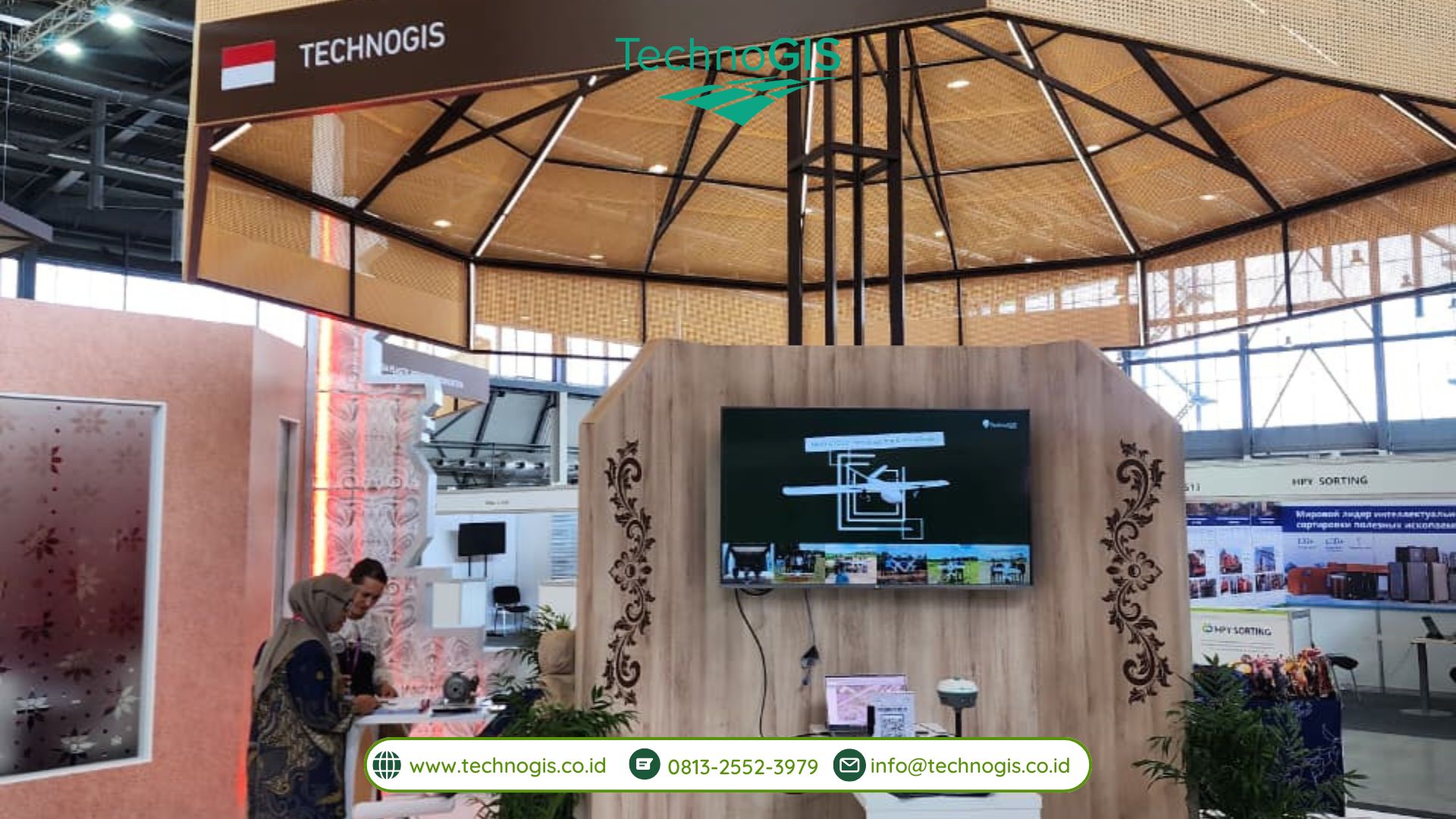
PT Techno GIS Indonesia Showcases Indonesia’s Geospatial Innovation at INNOPROM 2026 as Part of Indonesia’s Partner Country Delegation

Yekaterinburg, Russia — 2026

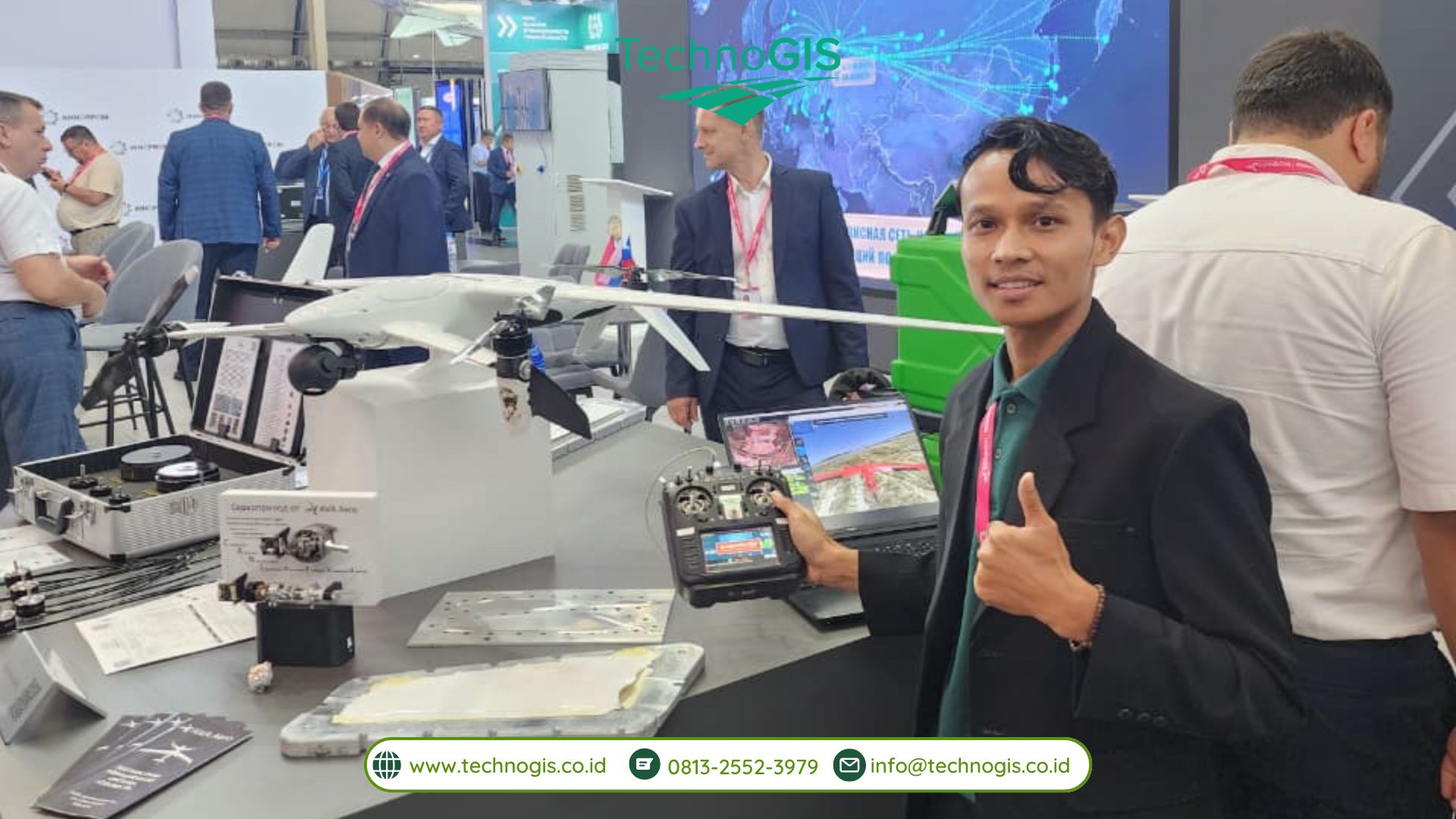
PT Techno GIS Indonesia proudly participates in INNOPROM 2026 as one of Indonesia’s technology companies bringing geospatial innovation to the global industrial stage. Indonesia’s role as Partner Country at this prestigious international industrial exhibition represents a strategic opportunity to showcase the nation’s capabilities, innovation, and competitiveness in the global market.

INNOPROM 2026 serves as a major international industrial platform that brings together industry leaders, technology companies, investors, and key stakeholders from various countries. Through Indonesia’s participation as Partner Country, national industries are given the opportunity to present innovative products, solutions, and technologies that support modern industrial development and digital transformation.

As a company specializing in geospatial technology and surveying solutions, PT Techno GIS Indonesia presents advanced solutions that support data-driven industries and digital transformation initiatives. At INNOPROM 2026, TechnoGIS showcases its comprehensive portfolio, including GNSS RTK Systems, UAV Mapping Solutions, Hydrographic Survey Equipment, Remote Sensing Technologies, and Geospatial Software Solutions.

These technologies are designed to support various strategic sectors, including infrastructure development, land management, environmental monitoring, smart city development, construction surveying, and industrial digitalization.

The participation of TechnoGIS Indonesia at INNOPROM 2026 demonstrates the growing importance of geospatial technology in building a more efficient, accurate, and sustainable industrial ecosystem. Through the utilization of high-quality spatial data and advanced surveying technologies, the company is committed to supporting organizations in making precise and data-driven decisions.

“PT Techno GIS Indonesia’s participation in INNOPROM 2026 represents an important opportunity to introduce Indonesia’s geospatial technology capabilities to the international community. We believe that accurate spatial data and modern mapping technologies play a fundamental role in supporting infrastructure development, resource management, and industrial digital transformation,” said Anton Prasetyo, Chief Technology Officer (CTO) of PT Techno GIS Indonesia.

Anton Prasetyo added, “Through this participation, we are also creating opportunities for collaboration with global partners to develop innovative geospatial solutions that address future industrial challenges. We aim to demonstrate that Indonesian technology companies are capable of delivering competitive solutions with strong value in the international market.”

As part of Indonesia’s industrial representation at INNOPROM 2026, PT Techno GIS Indonesia contributes to strengthening Indonesia’s position as a country with growing capabilities in technology, innovation, and industrial digitalization. This participation serves as a strategic step to expand international networks and introduce Indonesian geospatial solutions to global partners.

With a commitment to delivering spatial intelligence for diverse industrial needs, PT Techno GIS Indonesia continues to advance geospatial technology as a foundation for smarter planning, sustainable development, and data-driven decision-making.

TechnoGIS Showcases Smart Geospatial Solutions at GWF 2026

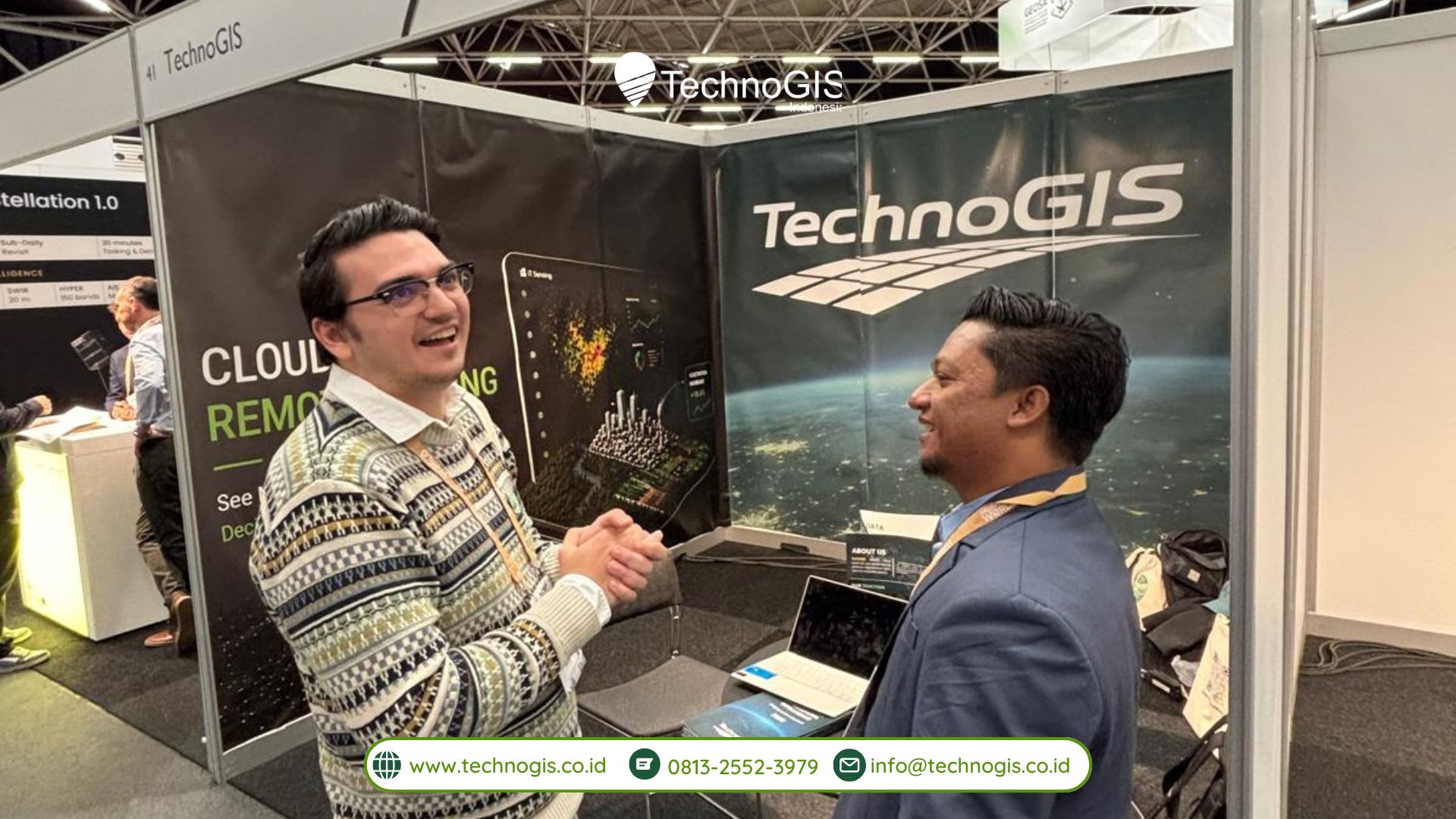
TechnoGIS participated in the Geospatial World Forum 2026 Conference & Tech Show, which took place from April 29 to May 1, 2026, at RAI Amsterdam, The Netherlands. During this international event, TechnoGIS joined the exhibition as one of the participating companies at Booth 41 and introduced its geospatial technologies and solutions to a global audience consisting of professionals, researchers, government representatives, technology providers, and industry stakeholders from many countries.

The participation of TechnoGIS in Geospatial World Forum 2026 became an important milestone for the company in strengthening its presence in the international geospatial industry. The event provided a strategic platform for TechnoGIS to showcase its innovations, exchange knowledge with global experts, and establish new connections with organizations involved in geospatial technology, remote sensing, mapping, and spatial data management. Through this opportunity, TechnoGIS demonstrated its commitment to supporting the development of modern geospatial solutions that can answer various challenges in today’s rapidly evolving digital era.

During the exhibition session, TechnoGIS presented a range of technologies designed to support modern surveying, mapping, monitoring, and geospatial data analysis. These technologies included GNSS RTK equipment for high-precision positioning and surveying, drone-based mapping solutions for aerial data acquisition, mapping sensors for spatial data collection, and iT Sensing, a cloud-based platform developed to simplify and accelerate remote sensing image processing. Visitors from different sectors showed strong interest in the technologies presented, especially in solutions that improve efficiency, accuracy, and accessibility in geospatial workflows.

In addition to participating in the exhibition, TechnoGIS also took part as a speaker during one of the conference sessions. In this presentation, the company introduced iT Sensing as an innovative platform that enables users to process and analyze remote sensing imagery more effectively through cloud-based technology. The session explained how cloud computing can help reduce complex manual workflows, speed up data processing, and improve access to geospatial analysis for users from different professional backgrounds.

The presentation also highlighted the practical applications of iT Sensing in various sectors and industries. The platform can support land monitoring activities, environmental observation, urban and regional planning, infrastructure inspection, agricultural analysis, disaster management, and smart city development. By integrating remote sensing technology with cloud-based processing systems, iT Sensing offers a more efficient approach to spatial data analysis while helping users make faster and more informed decisions.

Through both the exhibition and speaker session, TechnoGIS reaffirmed its commitment to advancing geospatial technology and supporting innovation across different sectors. The company’s participation in Geospatial World Forum 2026 also represented a strategic effort to expand international collaboration opportunities, strengthen global partnerships, and introduce Indonesian geospatial innovation to a wider international market. The event allowed TechnoGIS to interact directly with global industry players and explore future opportunities for cooperation in research, technology development, and geospatial implementation.

TechnoGIS’ presence at Geospatial World Forum 2026 reflects its broader mission to deliver reliable, relevant, and innovative geospatial solutions for global users. By bringing technologies such as iT Sensing to the international stage, TechnoGIS continues to support data-driven decision-making, efficient remote sensing image processing, and smarter, more sustainable development initiatives in various parts of the world.

TechnoGIS Strengthens Global Partnerships at GeoConnect Asia 2026 Through Strategic MoU Signings

TechnoGIS Indonesia successfully participated in Geo Connect Asia 2026, held at the Sands Expo & Convention Centre, Singapore, one of Asia’s leading events for geospatial technology and innovation. The exhibition gathered global industry leaders, professionals, and innovators to explore the future of geospatial intelligence and digital transformation. Through its participation, TechnoGIS demonstrated its commitment to advancing geospatial solutions on an international scale.

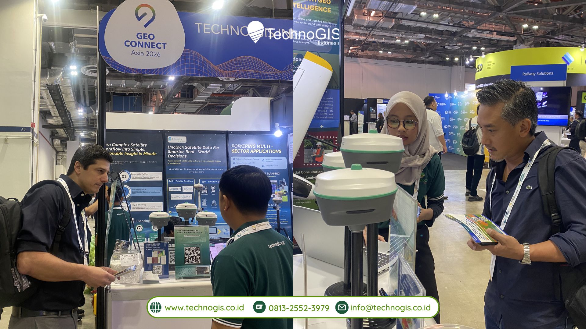
At the event, TechnoGIS showcased its latest Geo-AI platform, ITsensing, designed to deliver real-time geospatial insights and support data-driven decision-making. The platform integrates advanced analytics and artificial intelligence to enable efficient monitoring, analysis, and visualization of geospatial data across various applications. ITsensing reflects TechnoGIS’s continuous effort to provide innovative solutions that address the growing demand for intelligent and scalable geospatial technologies.

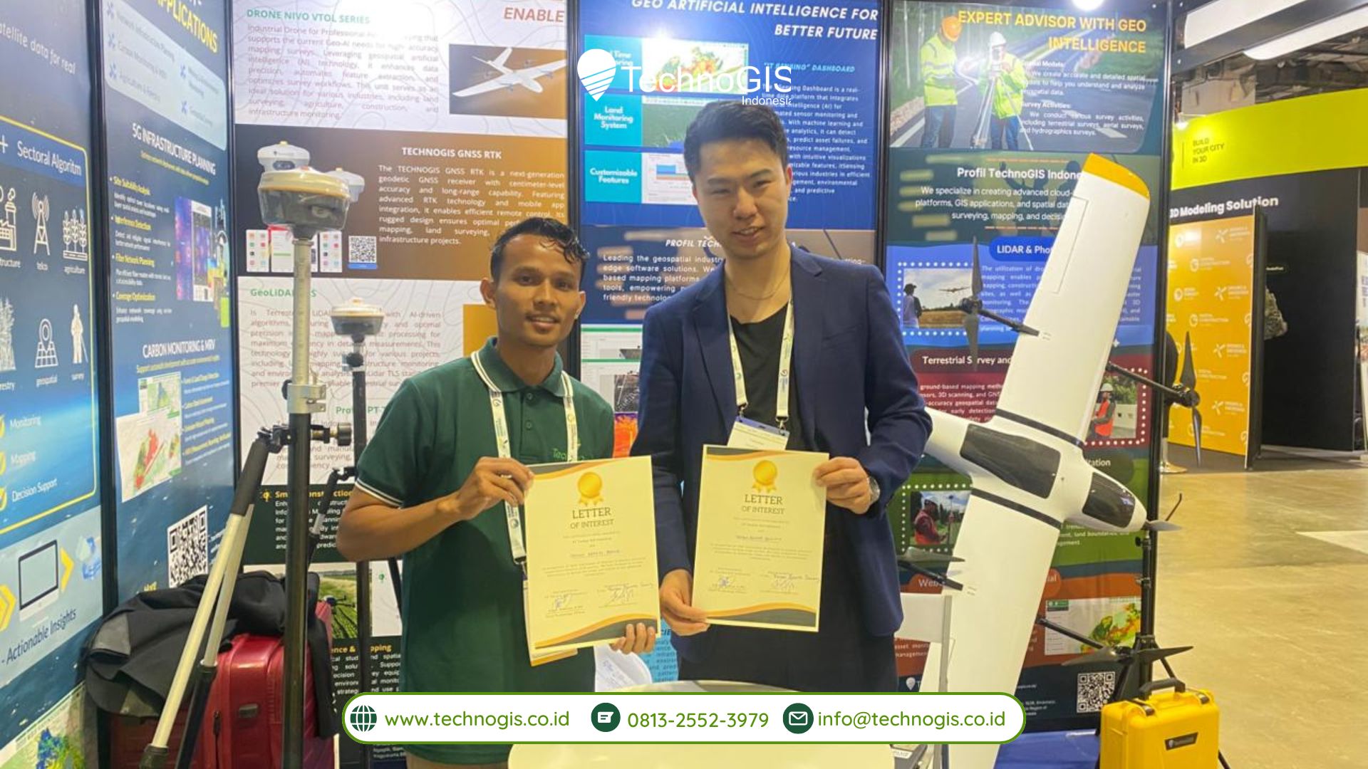
A key highlight of TechnoGIS’s participation at Geo Connect Asia 2026 was the signing of several Memorandums of Understanding (MoUs) with strategic international partners. These collaborations represent an important step in strengthening the company’s global network and expanding its technological capabilities.

Among the partners, TechnoGIS established collaboration with Feiyan Remote Sensing (China), a company specializing in remote sensing and advanced earth observation technologies. This partnership is expected to enhance capabilities in satellite-based data acquisition and analysis, supporting more comprehensive geospatial solutions.

In addition, TechnoGIS formalized cooperation with ECURS PTE Ltd (Singapore), an IT service provider with expertise in geospatial services, GIS implementation, and remote sensing solutions. This collaboration aims to strengthen regional service development and improve the integration of geospatial technologies across Southeast Asia.

TechnoGIS also partnered with ShenZhen Dingyao Science & Technology Co., Ltd (China), a company focused on research and development of GNSS antennas and radio frequency components. This partnership supports advancements in positioning technology and geospatial hardware, further enhancing the overall geospatial ecosystem.

These strategic partnerships aim to accelerate the adoption of intelligent geospatial solutions by combining TechnoGIS’s ITsensing platform with international expertise. Through this collaboration, TechnoGIS and its partners seek to drive joint innovation and develop impactful projects across multiple sectors, including infrastructure monitoring, environmental analysis, smart city development, and digital transformation initiatives.

The MoU signings at GeoConnect Asia 2026 highlight TechnoGIS’s proactive approach in building global partnerships and fostering innovation. By leveraging cross-border collaboration, the company aims to deliver more comprehensive and integrated solutions that meet the evolving needs of industries worldwide.

Through its participation in GeoConnect Asia 2026, TechnoGIS Indonesia further strengthens its position as a forward-thinking geospatial technology provider. The company remains committed to delivering data-driven solutions that support sustainable development and smarter decision-making.

Looking ahead, TechnoGIS will continue to expand its global footprint, enhance its technological capabilities, and collaborate with international partners to shape the future of geospatial intelligence in an increasingly connected and data-driven world.

TechnoGIS Highlights Thought Leadership at GeoConnect Asia 2026 Through Tech Talk Session

TechnoGIS Indonesia successfully participated in Geo Connect Asia 2026, held at the Sands Expo & Convention Centre, Singapore, one of Asia’s leading events in geospatial technology and innovation. The exhibition brought together global industry leaders, professionals, and innovators to explore the future of geospatial intelligence and digital transformation in the era of artificial intelligence. Through its active participation, TechnoGIS reaffirmed its commitment to advancing geospatial technology on an international stage.

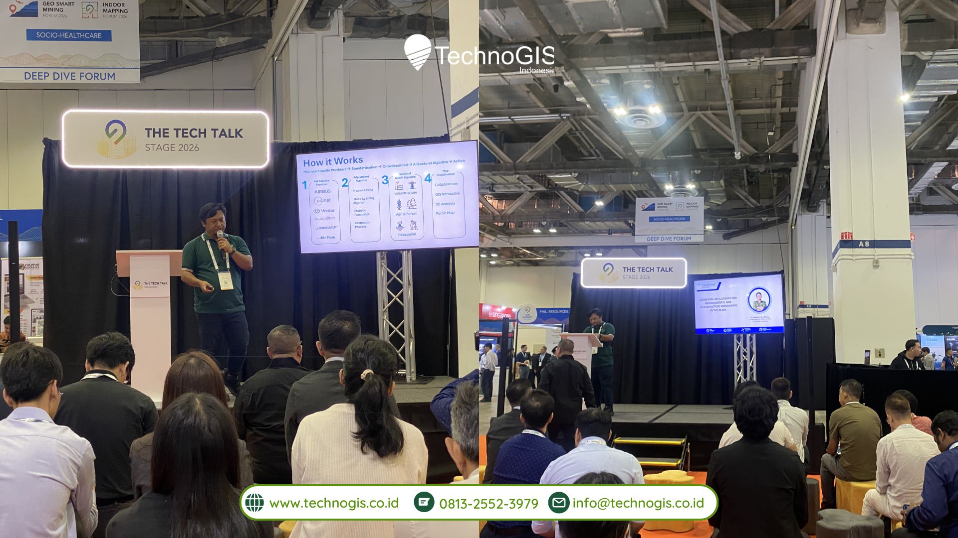
As part of the event, TechnoGIS contributed not only through its exhibition presence but also through thought leadership in a dedicated Tech Talk session. Representing the company, Ir. Sarono, S.Si., M.Eng, CEO of TechnoGIS Indonesia, was invited as a speaker to share insights on the evolving role of geospatial intelligence in supporting digital transformation across industries.

In his presentation, Ir. Sarono discussed the growing importance of integrating geospatial technologies with artificial intelligence to create more intelligent, data-driven solutions. He highlighted how geospatial intelligence is increasingly becoming a key enabler in addressing complex challenges in infrastructure development, environmental monitoring, and urban planning. By leveraging advanced analytics and real-time data processing, organizations can improve decision-making, enhance operational efficiency, and support sustainable development initiatives.

The Tech Talk session received strong engagement from international audiences, including industry professionals, technology experts, and potential collaborators. The discussion sparked meaningful exchanges of ideas and opened opportunities for future partnerships, particularly in areas related to smart infrastructure, sustainability, and digital transformation. The positive response reflected the increasing global interest in innovative geospatial solutions that can deliver tangible impact across sectors.

TechnoGIS’s participation in Geo Connect Asia 2026, especially through its contribution to the Tech Talk session, further strengthens its position as an innovative Indonesian geospatial technology provider. The company continues to play an active role in promoting the adoption of data-driven solutions that align with global technological trends and industry demands.

By combining expertise in geospatial technology with a forward-looking approach to innovation, TechnoGIS aims to support the development of smarter, more connected, and sustainable systems. Its involvement in international forums such as Geo Connect Asia provides a valuable platform to exchange knowledge, build strategic relationships, and showcase Indonesia’s growing capabilities in the global geospatial industry.

Looking ahead, TechnoGIS remains committed to expanding its global presence and contributing to the advancement of geospatial intelligence. Through continuous innovation, collaboration, and knowledge sharing, the company seeks to drive the future of digital transformation powered by geospatial data and artificial intelligence.

TechnoGIS Indonesia Showcases Geo-AI Innovation at GeoConnect Asia 2026, Singapore

TechnoGIS Indonesia successfully participated in the international event Geo Connect Asia 2026, held from March 31 to April 1, 2026, in Singapore. As part of one of Asia’s leading geospatial technology ecosystems, TechnoGIS’s presence marked a strategic step in introducing advanced data-driven innovations to support digital transformation across various industries.

Carrying the theme “Transforming Technology into Data-Driven Solutions: Underground, Land & Sea to Sky,” TechnoGIS presented its latest Geo-AI innovation through the ITsensing platform. This solution is designed to transform geospatial data into actionable insights by leveraging artificial intelligence and real-time monitoring capabilities. ITsensing enables users to perform asset monitoring, visual inspections, and predictive analysis with greater efficiency, accuracy, and scalability.

The platform reflects TechnoGIS’s commitment to delivering cutting-edge geospatial solutions that address the growing demand for intelligent data processing and decision-making tools. By integrating AI-driven analytics with geospatial technologies, ITsensing supports a wide range of applications, including infrastructure monitoring, environmental management, urban planning, and industrial operations.

During the two-day exhibition, the TechnoGIS booth attracted significant attention from visitors, industry professionals, and global technology stakeholders. The strong engagement, both through interactive discussions and live technology demonstrations, highlighted the increasing interest in innovative geospatial solutions that can effectively address modern industry challenges. Attendees showed particular enthusiasm for ITsensing’s ability to deliver real-time insights and predictive capabilities, which are essential for improving operational efficiency and strategic planning.

In addition to showcasing its technology, TechnoGIS also utilized the event as an opportunity to strengthen its international presence and expand its professional network. The participation in GeoConnect Asia 2026 provided valuable exposure to global markets and opened new avenues for collaboration with industry partners, technology providers, and potential clients from across the region and beyond.

This milestone further reinforces TechnoGIS Indonesia’s position as an innovative geospatial solutions provider aligned with global technological advancements. The company continues to focus on developing intelligent, scalable, and data-driven solutions that support sustainable growth and digital transformation initiatives worldwide.

Looking ahead, TechnoGIS remains committed to advancing its Geo-AI capabilities and expanding the reach of its ITsensing platform. By continuously innovating and collaborating with global partners, the company aims to contribute to smarter decision-making processes and more efficient resource management across industries.

Through its participation in GeoConnect Asia 2026, TechnoGIS has demonstrated not only its technological capabilities but also its vision to become a key player in the global geospatial industry, delivering impactful solutions for a smarter and more connected future.

Kapan Memilih Drone VTOL: Panduan Profesional untuk Operasi Udara Modern

Teknologi drone terus berkembang pesat, dan salah satu inovasi yang menonjol adalah drone VTOL (Vertical Take-Off and Landing). Kombinasi kemampuan lepas landas vertikal seperti helikopter dan efisiensi terbang jarak jauh seperti pesawat fixed-wing membuat VTOL menjadi solusi menarik bagi berbagai industri. Namun, pemilihan drone jenis ini harus didasarkan pada kebutuhan operasional yang spesifik. Artikel ini membahas secara sistematis kapan drone VTOL, seperti Nivo VTOL, menjadi pilihan optimal.


Apa Itu Drone VTOL?

Drone VTOL adalah jenis drone hybrid yang dapat lepas dan mendarat secara vertikal tanpa landasan pacu, tetapi juga mampu terbang maju seperti pesawat fixed-wing. Keunggulan ini memberikan fleksibilitas dan efisiensi yang tidak dimiliki drone multirotor tradisional.


1. Ketika Ruang Lepas Landas Terbatas

Salah satu alasan utama memilih drone VTOL adalah keterbatasan area untuk lepas landas dan mendarat.

  • Operasi di kota atau kawasan sempit: Gedung, area konstruksi, atau lokasi penelitian perkotaan.
  • Medan sulit: Hutan, pegunungan, atau lokasi pertanian yang jauh dari landasan pacu.

Mengapa VTOL unggul: Drone dapat lepas landas dari titik kecil tanpa membutuhkan ruang tambahan, menghemat waktu dan tenaga.


2. Ketika Misi Memerlukan Jangkauan Terbang Panjang

Drone multirotor biasa terbatas oleh durasi baterai karena harus mengangkat diri secara vertikal terus-menerus. VTOL memanfaatkan sayap untuk aerodinamika, sehingga dapat:

  • Terbang lebih jauh dengan konsumsi energi lebih rendah.
  • Efektif untuk survei lahan luas, pemetaan wilayah, atau monitoring infrastruktur panjang.
  • Mengurangi jumlah pengisian baterai atau penggantian drone saat misi panjang.

Contoh penggunaan: Survei tambang, pemetaan perkebunan, inspeksi jalur pipa atau rel kereta.


3. Ketika Butuh Data Berkualitas Tinggi

VTOL memungkinkan integrasi sensor canggih tanpa kompromi performa:

  • Kamera resolusi tinggi untuk foto udara profesional.
  • Sensor multispektral untuk pertanian presisi.
  • LiDAR untuk pemetaan 3D dan inspeksi infrastruktur.

Manfaat nyata: Data yang akurat dapat langsung digunakan untuk analisis lanjutan, mitigasi risiko, atau perencanaan strategis.


4. Ketika Operasi Profesional Memerlukan Fleksibilitas

Drone VTOL unggul untuk aplikasi lintas industri:

  • Pertanian presisi: Pemantauan kesehatan tanaman dan irigasi.
  • Konstruksi dan pemetaan: Survei lahan dan monitoring proyek.
  • Inspeksi infrastruktur: Menjangkau area sulit seperti jembatan, menara, dan jaringan listrik.
  • Dokumentasi visual: Film industri, media, dan promosi komersial.

VTOL memberi fleksibilitas untuk berpindah antara operasi multirotor dan fixed-wing tanpa mengganti platform.


5. Kapan VTOL Mungkin Tidak Ideal

Meskipun unggul, VTOL tidak selalu menjadi pilihan terbaik:

  • Anggaran terbatas: Harga drone VTOL dan sensor profesional lebih tinggi.
  • Operator tanpa pelatihan teknis: Pengoperasian hybrid membutuhkan skill lebih dibanding drone multirotor standar.
  • Transportasi lapangan terbatas: Beberapa model VTOL lebih besar dan butuh ruang lebih untuk dibawa.
  • Cuaca ekstrem: Fixed-wing sensitif terhadap angin kencang saat terbang maju.

Kesimpulan

Drone VTOL, seperti Nivo VTOL, merupakan investasi strategis bagi profesional yang:

  • Memerlukan lepas landas di area terbatas
  • Butuh jangkauan terbang panjang dan durasi lama
  • Mengutamakan kualitas data tinggi dari sensor profesional
  • Membutuhkan fleksibilitas aplikasi di berbagai industri

Pemilihan VTOL menjadi rasional ketika proyek menuntut efisiensi, kecepatan, dan kualitas data sekaligus, sementara kendala anggaran, pelatihan, atau cuaca perlu diperhitungkan.

Kelebihan dan Kekurangan Menggunakan Drone Nivo VTOL untuk Aplikasi Profesional

Inovasi drone VTOL (Vertical Take‑Off and Landing) mengubah cara profesional memanfaatkan teknologi udara. Salah satu produk yang mulai menarik perhatian adalah Nivo VTOL — sebuah platform yang menggabungkan kemampuan terbang vertikal seperti multirotor dengan efisiensi jangkauan fixed‑wing. Namun, seperti teknologi lainnya, Nivo VTOL memiliki keunggulan sekaligus keterbatasan yang perlu dipahami sebelum investasi. Artikel ini membahas secara empiris pro dan kontra penggunaan drone Nivo VTOL, membantu pembaca membuat keputusan berbasis kebutuhan operasional.


🔍 Apa Itu Drone Nivo VTOL?

Drone Nivo VTOL dirancang untuk operasi udara profesional dengan kemampuan lepas dan mendarat secara vertikal tanpa landasan pacu, sekaligus efisiensi terbang panjang layaknya pesawat fixed‑wing. Kombinasi ini menjadikannya populer di sektor pemetaan, survei, pertanian presisi, dan inspeksi infrastruktur.


✅ Kelebihan (Pros) Menggunakan Nivo VTOL

1. Lepas dan Mendarat di Area Terbatas

Salah satu aspek paling kuat dari Nivo VTOL adalah kemampuannya melakukan lepas landas dan mendarat secara vertikal (VTOL). Ini sangat berbeda dari drone fixed‑wing tradisional yang membutuhkan landasan pacu mini.

Manfaat nyata:

  • Tidak perlu ruang luas atau landasan khusus.
  • Cocok untuk operasi di perkotaan, ladang sempit, atau medan pegunungan.
  • Mengurangi biaya logistik pada lokasi tanpa infrastruktur.

2. Jangkauan Terbang Lebih Jauh

Desain fixed‑wing memungkinkan Nivo berdiri lebih efisien dalam hal aerodinamika dibanding drone multirotor biasa.

Keunggulan operasional:

  • Jangkauan lebih panjang dalam sekali terbang.
  • Efektif untuk pemetaan wilayah luas atau rute survei panjang.
  • Menghemat waktu pengerjaan misi.

3. Durasi Terbang Lebih Lama

Konsumsi energi pada fixed‑wing lebih rendah karena gaya angkat dari sayap membuat drone tidak terus‑menerus bekerja melawan gravitasi seperti multirotor.

Hasilnya:

  • Waktu terbang bisa lebih lama per baterai.
  • Mengurangi jumlah pengisian baterai saat pemetaan atau survei panjang.

4. Sensor dan Kamera Presisi Tinggi

Nivo VTOL biasanya dilengkapi sensor profesional seperti kamera pemetaan multispektral, LiDAR, atau modul video beresolusi tinggi.

Kelebihan teknis:

  • Mendukung pemetaan 2D/3D dengan akurasi tinggi.
  • Monitoring vegetasi, kondisi lahan, atau infrastruktur kritikal menjadi lebih efektif.
  • Data yang dihasilkan bisa langsung dipakai untuk analisis lanjutan.

5. Fleksibilitas Aplikasi

Karena kemampuan hybrid‑nya, Nivo VTOL bisa dipakai di banyak industri:

✔ Pertanian presisi
✔ Konstruksi dan pemetaan lahan
✔ Inspeksi jaringan listrik, jembatan, dan objek besar lainnya
✔ Dokumentasi visual untuk media atau film industri


❌ Kekurangan (Cons) Menggunakan Nivo VTOL

1. Harga Investasi Awal Relatif Tinggi

Drone VTOL umumnya berada di kelas premium dibanding drone multirotor konsumen atau hobi.

Pertimbangan biaya:

  • Harga perangkat inti lebih mahal.
  • Perlu biaya tambahan untuk sensor profesional, software, dan aksesori.
  • Mungkin belum ideal untuk usaha dengan anggaran terbatas.

2. Kompleksitas Operasional Lebih Tinggi

Walaupun VTOL memberikan fleksibilitas, mengoperasikan sistem hybrid fixed‑wing + multirotor membutuhkan keahlian lebih dibanding drone standar.

Implikasi teknis:

  • Pilot perlu pelatihan khusus.
  • Setting parameter penerbangan lebih kompleks.
  • Perlu pemahaman konversi antara fase vertikal dan forward flight.

3. Perawatan dan Servis Lebih Rumit

Desain lebih kompleks berarti lebih banyak komponen yang perlu dirawat, diservis, atau diganti.

Risiko operasional:

  • Biaya servis bisa lebih tinggi.
  • Butuh teknisi dengan keterampilan khusus.
  • Ketersediaan suku cadang mungkin terbatas tergantung wilayah.

4. Ketergantungan Pada Lingkungan Cuaca

Meskipun bukan kekurangan khusus Nivo (melainkan sebagian besar drone), fixed‑wing sangat sensitif terhadap angin kencang saat fase forward flight.

Dampak cuaca:

  • Turbulensi dapat memengaruhi stabilitas terbang.
  • Operasi mungkin harus ditunda jika kondisi angin tidak ideal.

5. Ukuran dan Mobilitas Lapangan

Beberapa model VTOL, termasuk Nivo, cenderung lebih besar dan kurang ringkas dibanding multirotor kecil.

Konsekuensi:

  • Transportasi ke lokasi membutuhkan ruang lebih besar.
  • Persiapan lapangan perlu area cukup untuk manuver.

TechnoGIS Strengthens Global Expansion at Smart City Expo Taiwan 2026

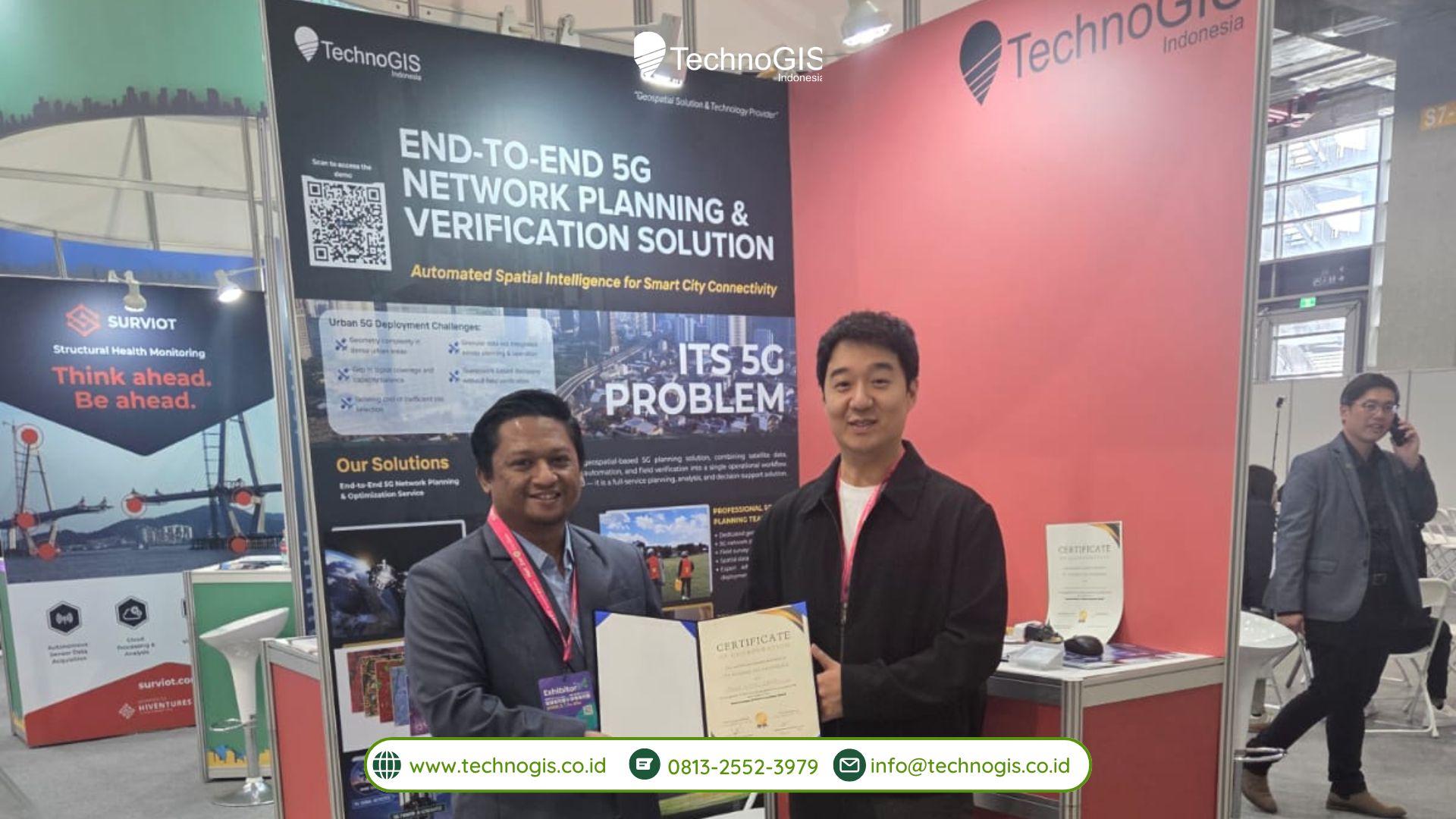
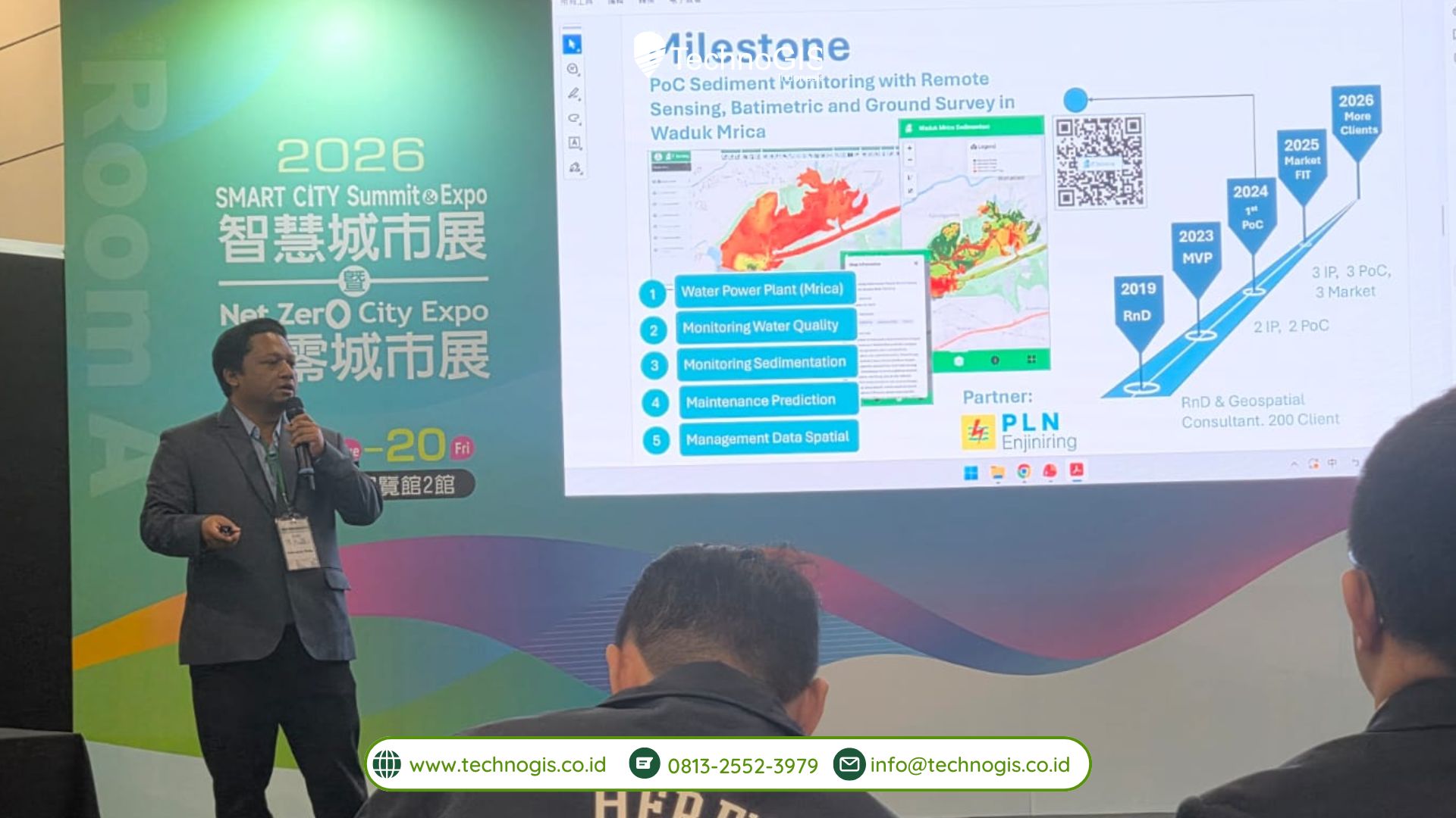
TechnoGIS reaffirmed its commitment to advancing global geospatial technology through its participation in the Smart City Expo Taiwan 2026, held on March 17–20, 2026, at the Nangang Exhibition Center, Taipei. During the event, TechnoGIS showcased its flagship platform, iT Sensing, a cloud-based geospatial solution designed to transform satellite data into strategic insights for various industry applications.

The iT Sensing platform was introduced as an innovative solution to support smart city development, including 5G infrastructure planning. By integrating geospatial data, advanced analytics, and cloud-based processing, iT Sensing enhances efficiency and accuracy in data-driven decision-making. TechnoGIS’s participation in the event was supported by Indonesia Prima as an accelerator, which played a key role in expanding international networks and accelerating the company’s global growth.

As part of its international expansion strategy, TechnoGIS established several strategic partnerships through Memorandums of Understanding (MoUs) with global partners, including Hayani Maison (Africa), Collexe (Malaysia), Statio (Thailand), and Stellar Vision (Korea). These collaborations focus on developing and implementing geospatial solutions tailored to local needs across different regions.

In addition, TechnoGIS initiated multiple cross-border projects, including agriculture and forestry development in Malaysia in collaboration with Rymba and Hittera, geospatial solution development in Greece with Neuralio, and urban temperature modeling platform development in the Czech Republic with Ecoten Urban Comfort. Other initiatives include infrastructure monitoring in Africa, smart parking system development in Thailand with Statio and Riffai, and collaboration with SolarSDGs in Taiwan to develop drone-based solar panel monitoring and predictive maintenance systems.

CEO of TechnoGIS, Sarono, stated that participation in Smart City Expo Taiwan 2026 marks a strategic milestone in the company’s global expansion. He emphasized that collaborations established across more than seven countries in Asia, Africa, and Europe will serve as a strong foundation for future geospatial innovation. TechnoGIS remains optimistic about the growing role of geospatial technology in enabling smarter, more efficient, and sustainable urban development.

Through these initiatives and international collaborations, TechnoGIS continues to strengthen its position as a global geospatial technology company, while contributing to the advancement of data-driven solutions across various sectors.

RTK vs PPK: Metode Mana yang Lebih Efektif?

Dalam dunia survey dan pemetaan modern, dua metode yang paling sering digunakan pada teknologi Global Navigation Satellite System (GNSS) adalah Real-Time Kinematic (RTK) dan Post-Processed Kinematic (PPK). Keduanya sama-sama mampu menghasilkan akurasi tinggi hingga tingkat sentimeter, namun memiliki perbedaan mendasar dalam cara kerja, kebutuhan di lapangan, serta tingkat efisiensi.

Lalu, metode mana yang lebih efektif? Jawabannya sangat bergantung pada kebutuhan proyek, kondisi lapangan, dan sumber daya yang tersedia.

Apa Itu RTK (Real-Time Kinematic)?

RTK adalah metode pengukuran GNSS yang memberikan hasil koordinat secara real-time di lapangan. Sistem ini bekerja dengan menggunakan base station yang mengirimkan koreksi data ke rover melalui koneksi radio atau internet (NTRIP).

Kelebihan RTK:

  • Hasil langsung (real-time) tanpa menunggu proses tambahan
  • Sangat efisien untuk pekerjaan lapangan
  • Cocok untuk staking out dan monitoring proyek

Kekurangan RTK:

  • Bergantung pada koneksi (internet/radio)
  • Rentan terhadap gangguan sinyal di area tertutup (hutan, perkotaan padat)
  • Membutuhkan setup base atau akses ke CORS

Apa Itu PPK (Post-Processed Kinematic)?

PPK adalah metode pengolahan data GNSS yang dilakukan setelah pengumpulan data selesai. Data dari rover akan dikoreksi menggunakan data dari base station atau CORS melalui software post-processing.

Kelebihan PPK:

  • Tidak membutuhkan koneksi internet saat survei
  • Lebih stabil di area sulit sinyal (hutan, lembah, dll.)
  • Akurasi tetap tinggi bahkan dalam kondisi challenging

Kekurangan PPK:

  • Tidak mendapatkan hasil secara langsung
  • Membutuhkan waktu tambahan untuk proses pengolahan data
  • Kurang cocok untuk pekerjaan yang butuh keputusan cepat di lapangan

Mana yang Lebih Efektif?

RTK lebih efektif untuk:

  • Proyek konstruksi dan infrastruktur
  • Stake out dan setting posisi langsung
  • Monitoring real-time
  • Pekerjaan dengan deadline cepat

PPK lebih efektif untuk:

  • Area tanpa jaringan internet
  • Lokasi dengan gangguan sinyal tinggi
  • Survei di hutan, pegunungan, atau daerah terpencil
  • Proyek yang mengutamakan kualitas data tanpa tekanan waktu

Kesimpulan

Baik RTK maupun PPK memiliki keunggulan masing-masing dan sama-sama menghasilkan data dengan akurasi tinggi. RTK unggul dalam kecepatan dan efisiensi kerja lapangan, sementara PPK lebih unggul dalam fleksibilitas dan stabilitas pada kondisi sulit.

Dalam praktiknya, banyak profesional survei justru mengkombinasikan kedua metode ini untuk mendapatkan hasil terbaik: RTK untuk pekerjaan real-time, dan PPK sebagai backup atau validasi data.