Surveying the Future of Infrastructure and Development
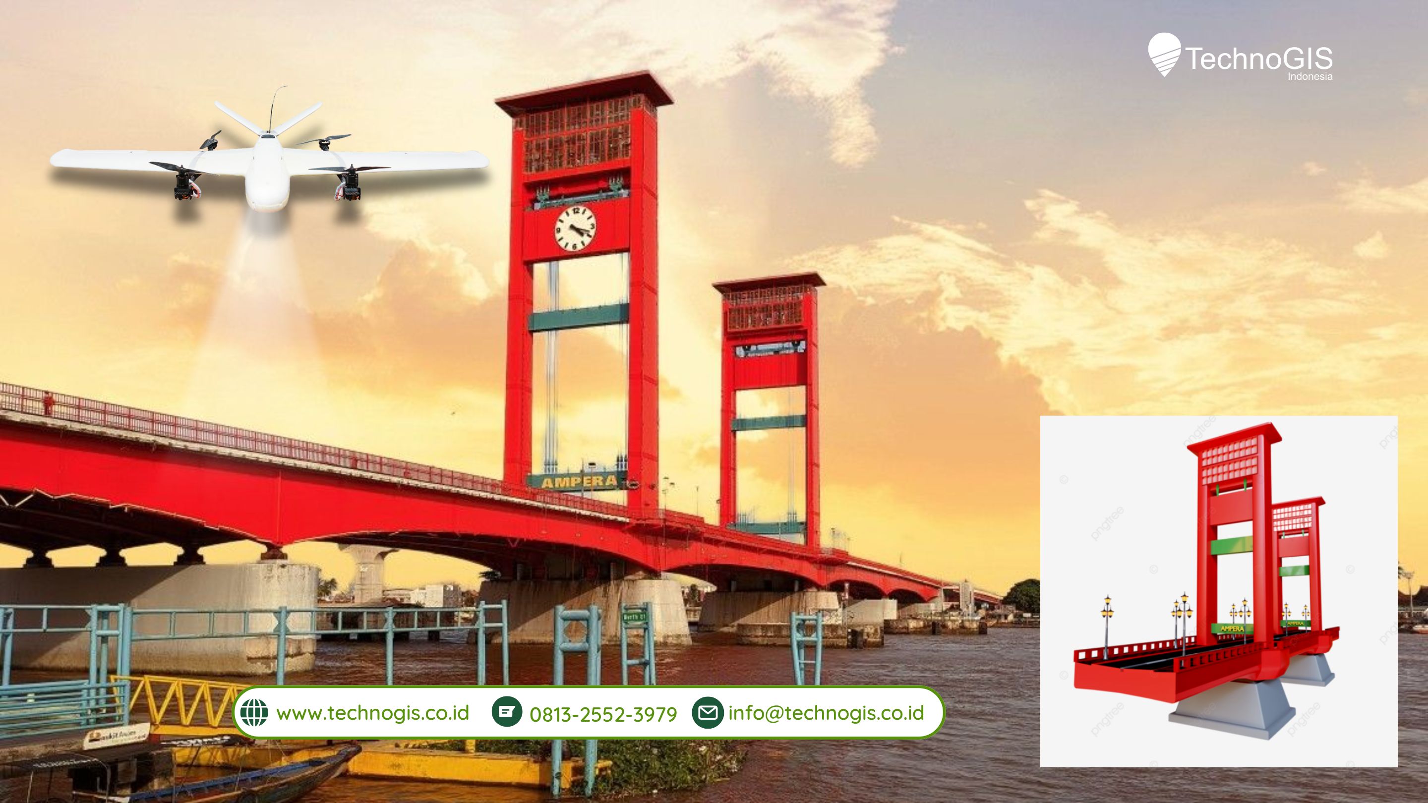
In the fast-paced world of infrastructure development, precise and efficient surveying is essential to ensure the success of projects, from urban planning to large-scale construction. The NIVO VTOL V5 Pro Lidar drone provides a groundbreaking solution to the challenges faced by professionals in this field. By offering high-precision data collection and the ability to survey vast areas quickly, this drone is changing the way infrastructure surveys are conducted. Its advanced sensors and LiDAR technology enable it to capture detailed 3D data, which is crucial for creating accurate terrain models and making informed decisions during the planning and construction phases.
The NIVO VTOL V5 Pro is also a game-changer in terms of efficiency. Infrastructure projects often span large sites, and traditional methods can be time-consuming and costly. With the ability to cover up to 1000 hectares in a single flight, this drone drastically reduces the time needed for surveying, allowing projects to move forward faster. Additionally, its extended flight time and long-range telemetry ensure that it can reach remote or difficult-to-access areas, making it an invaluable tool for surveying expansive infrastructure projects.
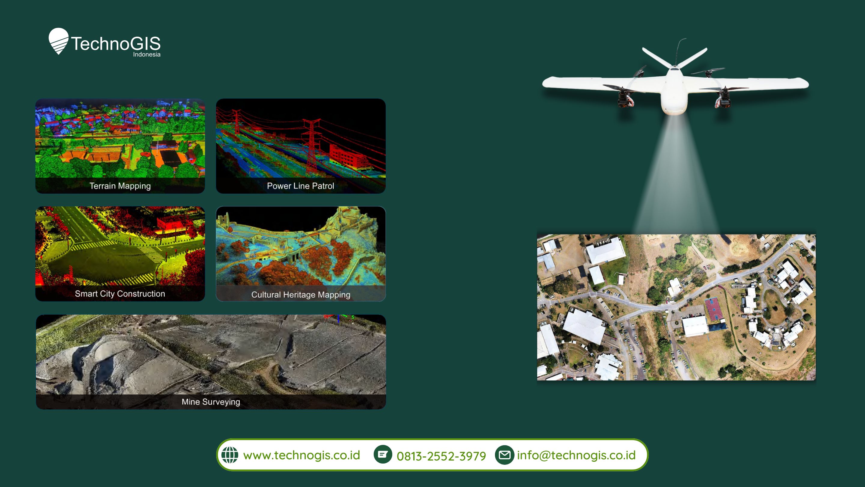
The drone’s versatility is another standout feature. It operates effectively in a wide range of environments, whether in dense urban areas, forests, or rugged terrains. This flexibility means professionals can rely on the NIVO VTOL V5 Pro for a variety of tasks, from mapping power lines and conducting environmental assessments to inspecting buildings and infrastructure. Its ability to adapt to different conditions makes it the ideal companion for the diverse demands of infrastructure development.
For cities expanding at an ever-increasing rate, the NIVO VTOL V5 Pro plays a crucial role in smart city initiatives and urban development projects. By generating accurate digital models, such as Digital Surface Models (DSM) and Digital Terrain Models (DTM), the drone provides urban planners with a clear and detailed view of the land they are working with. These models are essential for designing infrastructure that is both functional and sustainable, ensuring that cities can grow efficiently and responsibly.
Moreover, the NIVO VTOL V5 Pro offers a safer and more sustainable approach to surveying. Traditional methods often require workers to be exposed to hazardous environments, which can be risky and labor-intensive. By conducting surveys remotely, the drone reduces the need for on-ground labor in dangerous areas, lowering the risk to workers and minimizing the environmental impact associated with heavy machinery. This makes the NIVO VTOL V5 Pro not only a practical choice but also a more eco-friendly and safer option for infrastructure surveying.
In conclusion, the NIVO VTOL V5 Pro Lidar drone is revolutionizing the way infrastructure surveys are conducted. Its precision, efficiency, and adaptability make it a vital tool for professionals involved in construction, urban planning, and environmental management. By embracing this advanced technology, infrastructure developers can improve the accuracy and speed of their projects while promoting safer and more sustainable practices.

Leave a Reply
Want to join the discussion?Feel free to contribute!