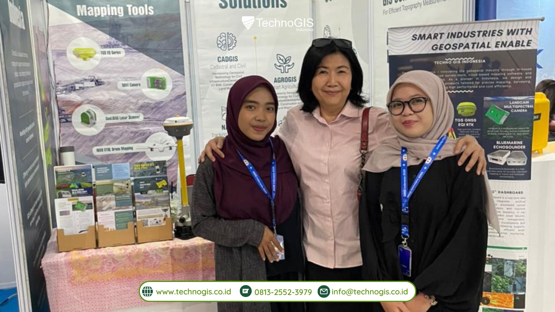
TechnoGIS Indonesia Highlights TechnoGIS GNSS RTK and Advanced Geospatial Technologies at GNSS Indonesia Summit & Expo 2025: Advancing Positioning Technology for Indonesia Future
Depok, November 23, 2025 – TechnoGIS Indonesia once again demonstrated its strong commitment to advancing the nation’s geospatial ecosystem through its participation at the GNSS Indonesia Summit & Expo 2025, held from 19-23 November 2025. As one of Indonesia’s leading innovators in mapping and positioning technology, TechnoGIS Indonesia showcased a series of advanced solutions designed to support efficiency, accuracy, and modernization across multiple industries, especially those relying heavily on precise spatial data.
During this five-day national-scale event, GNSS Indonesia Summit & Expo 2025 gathered major industry players, technology providers, and geospatial professionals to highlight the future of advanced positioning technology in Indonesia. Standing among these forward-thinking companies, TechnoGIS Indonesia presented a portfolio of solutions that reflect its mission to empower smarter decision-making and accelerate the adoption of modern geospatial tools.
One of the main highlights at the TechnoGIS booth was the TechnoGIS GNSS RTK, a next-generation positioning system developed to deliver high-precision, real-time accuracy in even the most challenging field conditions. Thanks to its powerful specifications and user-oriented design, TechnoGIS GNSS RTK quickly captured the attention of visitors, surveyors, and industry experts throughout the event. The system enables significantly faster workflows, simplified field operations, and enhanced data reliability, making it an ideal solution for land surveying, construction, agricultural planning, and national infrastructure development.
In addition to the TechnoGIS GNSS RTK, TechnoGIS Indonesia also showcased other complementary technologies that support complete and integrated mapping operations. These include the Bluemarine Echosounder, a robust hydrographic instrument designed for underwater depth measurement, and Geodetic GPS equipment that plays a crucial role in achieving accurate geodetic control points. Together, these products represent TechnoGIS Indonesia’s broader capability to deliver end-to-end geospatial solutions across terrestrial and marine environments.

Revolutionized mapping industry through latest technology
Throughout the exhibition, the TechnoGIS booth became a hub of insightful discussions, product demonstrations, and knowledge exchange. Visitors had the opportunity to explore how modern GNSS and mapping technologies can enhance project outcomes, reduce operational time, and expand data-driven decision-making across industries. The positive engagement from attendees reflected a growing awareness of the importance of geospatial innovation in shaping Indonesia’s future.
As Indonesia continues to embrace Industry 4.0 and smart-infrastructure development, TechnoGIS Indonesia remains dedicated to delivering cutting-edge tools and solutions that support national progress. The successful presence at the GNSS Indonesia Summit & Expo 2025 marks another step in the company’s journey to strengthen the country’s geospatial capabilities and inspire future innovations that will shape the mapping and positioning industry for years to come.
Thank you for visit us at GNSS Indonesia Summit & Expo 2025
TechnoGIS Indonesia extends its deepest appreciation and thank you to all visitors, partners, and also industry professionals who took the time to visit our booth. Your support, engagement, and enthusiasm inspire us to continue innovating and contributing to Indonesia’s geospatial future.
Tags:#TechnoGISIndonesia #TechnoGISGNSSRTK #GNSSIndonesiaSummit2025 #Geospatialtechnology #Mappingtechnologyindonesia #Echosounderbluemarine #GeodeticGPS #Surveyingequipment #Surveyingandmappingsolutions #GNSStechnologyindonesia

Leave a Reply
Want to join the discussion?Feel free to contribute!