
TechnoGIS Strengthens Global Partnerships at GeoConnect Asia 2026 Through Strategic MoU Signings
TechnoGIS Indonesia successfully participated in Geo Connect Asia 2026, held at the Sands Expo & Convention Centre, Singapore, one of Asia’s leading events for geospatial technology and innovation. The exhibition gathered global industry leaders, professionals, and innovators to explore the future of geospatial intelligence and digital transformation. Through its participation, TechnoGIS demonstrated its commitment to advancing geospatial solutions on an international scale.
At the event, TechnoGIS showcased its latest Geo-AI platform, ITsensing, designed to deliver real-time geospatial insights and support data-driven decision-making. The platform integrates advanced analytics and artificial intelligence to enable efficient monitoring, analysis, and visualization of geospatial data across various applications. ITsensing reflects TechnoGIS’s continuous effort to provide innovative solutions that address the growing demand for intelligent and scalable geospatial technologies.
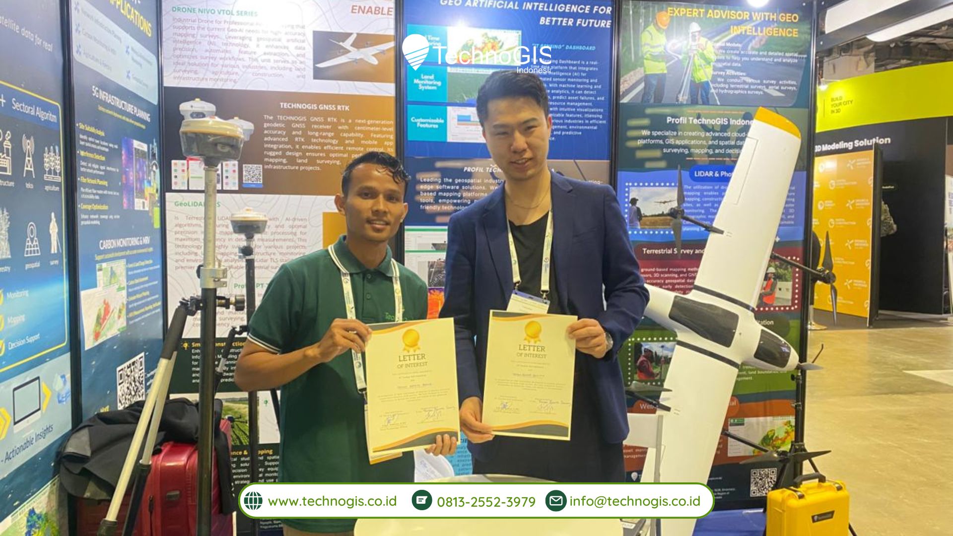
A key highlight of TechnoGIS’s participation at Geo Connect Asia 2026 was the signing of several Memorandums of Understanding (MoUs) with strategic international partners. These collaborations represent an important step in strengthening the company’s global network and expanding its technological capabilities.
Among the partners, TechnoGIS established collaboration with Feiyan Remote Sensing (China), a company specializing in remote sensing and advanced earth observation technologies. This partnership is expected to enhance capabilities in satellite-based data acquisition and analysis, supporting more comprehensive geospatial solutions.
In addition, TechnoGIS formalized cooperation with ECURS PTE Ltd (Singapore), an IT service provider with expertise in geospatial services, GIS implementation, and remote sensing solutions. This collaboration aims to strengthen regional service development and improve the integration of geospatial technologies across Southeast Asia.
TechnoGIS also partnered with ShenZhen Dingyao Science & Technology Co., Ltd (China), a company focused on research and development of GNSS antennas and radio frequency components. This partnership supports advancements in positioning technology and geospatial hardware, further enhancing the overall geospatial ecosystem.
These strategic partnerships aim to accelerate the adoption of intelligent geospatial solutions by combining TechnoGIS’s ITsensing platform with international expertise. Through this collaboration, TechnoGIS and its partners seek to drive joint innovation and develop impactful projects across multiple sectors, including infrastructure monitoring, environmental analysis, smart city development, and digital transformation initiatives.
The MoU signings at GeoConnect Asia 2026 highlight TechnoGIS’s proactive approach in building global partnerships and fostering innovation. By leveraging cross-border collaboration, the company aims to deliver more comprehensive and integrated solutions that meet the evolving needs of industries worldwide.
Through its participation in GeoConnect Asia 2026, TechnoGIS Indonesia further strengthens its position as a forward-thinking geospatial technology provider. The company remains committed to delivering data-driven solutions that support sustainable development and smarter decision-making.
Looking ahead, TechnoGIS will continue to expand its global footprint, enhance its technological capabilities, and collaborate with international partners to shape the future of geospatial intelligence in an increasingly connected and data-driven world.

Leave a Reply
Want to join the discussion?Feel free to contribute!