• Call: +62274 – 885879
  • Chat : +62813-2552-3979
  • Mail : [email protected]
TGS Low Cost RTK Reciever | GIS Survey Mobile | GIS Cloud
  • 0Shopping Cart
TechnoGIS Indonesia
  • Home
  • About Us
  • Products
    • TGS Low Cost RTK Reciever
    • GIS Survey Mobile Apps
    • NiVO VTOL Drone Mapping
    • Blue Marine Echosounder
  • Solutions
    • CadGIS – Cadastral & Civil
    • AgroGIS – Agriculture
    • MinerGIS – Mining & Energy
    • DisasGIS – Disaster & Hazard
    • WisataGIS – Tourism Manage
    • DesaGIS – Urban Planning
    • BisnGIS – Geo Business Tools
    • NavnGIS – Navigation
  • News & Updates
  • Our Team
  • Store
  • Contact
  • Menu

Equator GNSS RTK

  • Sort by Default
    • Default
    • Custom
    • Name
    • Price
    • Date
    • Popularity (sales)
    • Average rating
    • Relevance
    • Random
    • Product ID
  • Display 12 Products per page
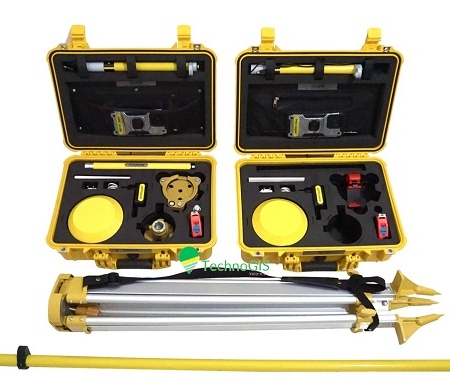
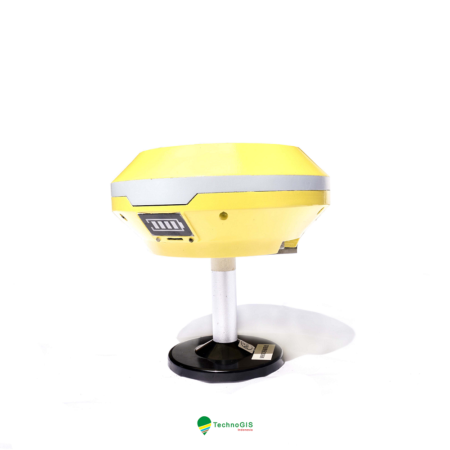
    • 12 Products per page
    • 24 Products per page
    • 36 Products per page
  • TGS GNSS EQ1 RTK – Dual Freq High Precision GNSS (GPS GEODETIK MURAH) – PAKET LENGKAP

    Rp 70.000.000,00 Rp 55.000.000,00 Sale!
    Add to cart Show Details
  • TGS GNSS EQ1 RTK – Dual Freq High Precision GNSS (GPS GEODETIK MURAH)

    Rp 22.500.000,00 Rp 19.500.000,00 Sale!
    Add to cart Show Details

About Us

TechnoGIS is a Geospatial technology company with superior low-cost survey tool products, cloud mapping software and geospatial data mapping and analysis services from Indonesia.

One of the best geospatial startup company in South East Asia with focusing on environment problem and bring solution to natural disaster, degradation foresty, land mapping and surveying, mining and energy also smart city.


Office Address

Main Office
Jl Pamularsih No.152 B,
Klaseman, Sinduharjo, Ngaglik, Sleman, Yogyakarta, Indonesia, 55283

PIDI 4.0 Building 8th Floor
Jl Raya Kby. Lama No.41, RT.6/RW.8, Sukabumi, Kb. Jeruk, West Jakarta, Indonesia, 11560

Phone : +62274 – 885879
Mobile : +62813-2552-3979
Email : [email protected]

Opening Hours

Mo-Fr: 8:00-17:00

TGS RTK GNSS – Low Cost GNSS RTK for mapping and surveying. NiVO Drone VTOL Mapping, GeoLiDAR, Blue Marine Echosounder.

Our Apps:

© Copyright 2015 - Techno GIS Indonesia
  • Facebook
  • Instagram
  • Gplus
  • Rss
  • Linkedin
  • Youtube
Scroll to top